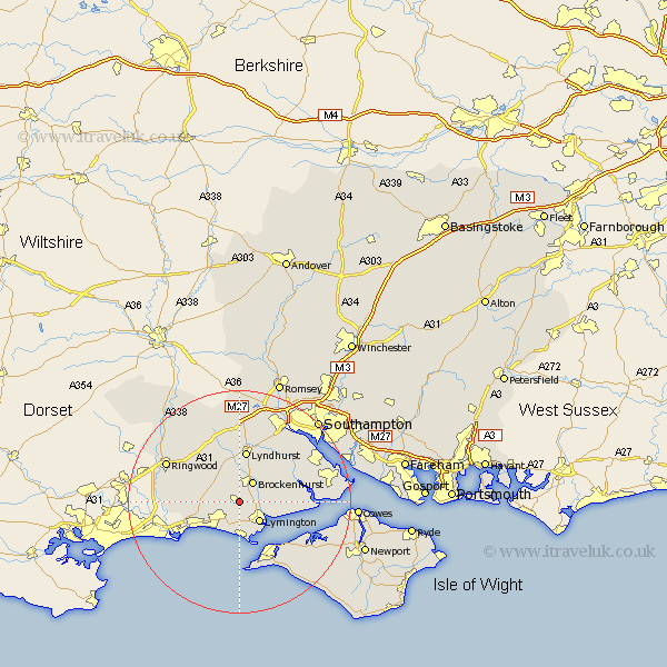
Hampshire Map Showing Location of Sway
Population: 2008
Area Size (ha): 84
District: New Forest
Easting: 428195 Northing: 98330
Latitude: 50.78 Longitude: -1.6
 = Sway
Area Size (ha): 84
District: New Forest
Easting: 428195 Northing: 98330
Latitude: 50.78 Longitude: -1.6
= Sway
This Sway map below is supplied by Google. Use the tools in the top left corner to zoom into street level or zoom out for a road map, you may also need to zoom in to see Sway on the map. Click and drag the map to move around. If the map fails to load try and refresh your browser or zoom in or out (+ or -).
Update - it seems Google no longer allow people to use their maps for free! This Sway map sometimes loads and sometimes gives a error. I am working on a solution.
Closest 30 Towns or Cities to Sway (Population over 500)
Hordle 3.7km Brockenhurst 4.39km Boldre 5.04km Lymington 5.11km Milford on Sea 6.5km Milford 6.5km Milford-on-Sea 6.5km New Milton 6.58km Milton 6.58km Burley 7.95km Barton 8.77km Barton-on-Sea 8.77km Barton on Sea 8.77km Lyndhurst 9.35km Bransgore 9.37km Minstead 11.12km Bewley 11.18km Beaulieu 11.18km Yarmouth 11.63km Sopley 13.02km Totland 13.79km Freshwater 14.23km Ringwood 14.86km Cadnam 14.88km Dibden 14.93km Eling 15.35km Marchwood 16.15km Bramshaw 16.72km Hythe 16.83km Shalfleet 16.85km