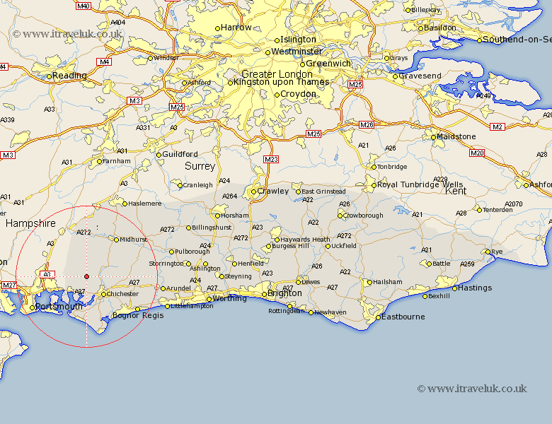
Sussex Map Showing Location of Stoughton
Population: 631
District: Chichester
Easting: 480888 Northing: 110003
Latitude: 50.88 Longitude: -0.85
 = Stoughton
District: Chichester
Easting: 480888 Northing: 110003
Latitude: 50.88 Longitude: -0.85
= Stoughton
This Stoughton map below is supplied by Google. Use the tools in the top left corner to zoom into street level or zoom out for a road map, you may also need to zoom in to see Stoughton on the map. Click and drag the map to move around. If the map fails to load try and refresh your browser or zoom in or out (+ or -).
Update - it seems Google no longer allow people to use their maps for free! This Stoughton map sometimes loads and sometimes gives a error. I am working on a solution.
Closest 30 Towns or Cities to Stoughton (Population over 500)
Stoughton 0km Funtington 2.98km Lavant 5.97km Westbourne 5.97km Southbourne 5.97km Fishbourne 6.57km Chichester 7.27km Bosham 7.5km East Harting 9.35km West Thorney 9.9km Boxgrove 10.06km Tangmere 10.06km Dunnington 10.38km Donnington 10.38km Oving 10.89km Birdham 11.18km North Mundham 11.62km Mundham 11.62km Iping 12.06km Sidlesham 12.06km Hayling Island 12.36km Graffham 12.94km Rogate 13.03km East Wittering 13.17km West Wittering 13.43km Midhurst 13.81km Pagham 14.75km Eastergate 15.1km Slindon 15.65km Bersted 16.14km