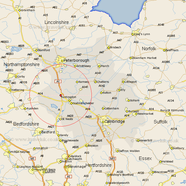
Cambridgeshire Map Showing Location of Alconbury
Population: 2440
Area Size (ha): 39
District: Huntingdonshire
Easting: 518003 Northing: 275750
Latitude: 52.37 Longitude: -0.27
 = Alconbury
Area Size (ha): 39
District: Huntingdonshire
Easting: 518003 Northing: 275750
Latitude: 52.37 Longitude: -0.27
= Alconbury
This Alconbury map below is supplied by Google. Use the tools in the top left corner to zoom into street level or zoom out for a road map, you may also need to zoom in to see Alconbury on the map. Click and drag the map to move around. If the map fails to load try and refresh your browser or zoom in or out (+ or -).
Update - it seems Google no longer allow people to use their maps for free! This Alconbury map sometimes loads and sometimes gives a error. I am working on a solution.
Closest 30 Towns or Cities to Alconbury (Population over 500)
Ellington 5.67km Spaldwick 5.86km Brampton 6km Brampton Grange 6km Huntingdon 6.77km Sawtry 7.41km Grafham 7.5km Graffham 7.5km Durolipons 8.78km Godmanchester 8.78km Buckden 9.34km Offord 10.32km Offord Cluny 10.32km Wyton 10.84km Kimbolton 10.86km Holme 11.35km Hemingford 11.61km Hemingford Grey 11.61km Wistow 11.9km Great Staughton 12.01km Bury 12.6km Hemingford Abbots 12.61km West Hemingford 12.61km Stilton 13.01km Little Paxton 13.03km Folksworth 13.16km Great Paxton 13.41km Ramsey 13.76km Warboys 14.07km Yaxley 14.86km