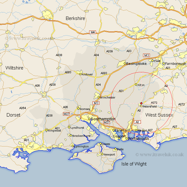
Hampshire Map Showing Location of Steep
Population: 1377
District: East Hampshire
Easting: 474812 Northing: 124748
Latitude: 51.02 Longitude: -0.93
 = Steep
District: East Hampshire
Easting: 474812 Northing: 124748
Latitude: 51.02 Longitude: -0.93
= Steep
This Steep map below is supplied by Google. Use the tools in the top left corner to zoom into street level or zoom out for a road map, you may also need to zoom in to see Steep on the map. Click and drag the map to move around. If the map fails to load try and refresh your browser or zoom in or out (+ or -).
Update - it seems Google no longer allow people to use their maps for free! This Steep map sometimes loads and sometimes gives a error. I am working on a solution.
Closest 30 Towns or Cities to Steep (Population over 500)
Petersfield 1.86km Liss 2.97km Greatham 4.38km Froxfield 4.66km Buriton 5.68km Selborne 7.41km East Meon 7.92km Upper Farringdon 9.9km Faringdon 9.9km Farringdon 9.9km Clanfield 10.38km West Meon 10.49km Liphook 10.85km Horndean 11.66km Ropley 11.87km Bramshot 11.9km Kingsley 12.06km Bordon Camp 12.55km Bordon 12.55km Bramdean 12.95km Alton 13.43km Four Marks 13.79km Headley 13.79km Medstead 14.51km Hambledon 14.52km Rowlands Castle 14.88km Corhampton 15.06km Binsted 15.23km Droxford 15.84km Froyle 16.72km