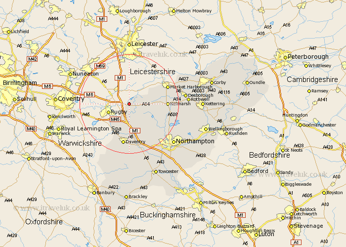
Northamptonshire Map Showing Location of Stanford On Avon
Population: 40
District: Daventry
Easting: 458959 Northing: 278393
Latitude: 52.4 Longitude: -1.13
 = Stanford On Avon
District: Daventry
Easting: 458959 Northing: 278393
Latitude: 52.4 Longitude: -1.13
= Stanford On Avon
This Stanford On Avon map below is supplied by Google. Use the tools in the top left corner to zoom into street level or zoom out for a road map, you may also need to zoom in to see Stanford On Avon on the map. Click and drag the map to move around. If the map fails to load try and refresh your browser or zoom in or out (+ or -).
Update - it seems Google no longer allow people to use their maps for free! This Stanford On Avon map sometimes loads and sometimes gives a error. I am working on a solution.
Closest 30 Towns or Cities to Stanford On Avon (Population over 500)
Yelvertoft 3.87km Welford 5.95km Crick 7.42km Kilsby 7.75km West Haddon 8.69km Barby 10.31km Naseby 10.35km Guilsborough 11.7km Long Buckby 12.01km Clipston 12.57km Welton 13.03km East Haddon 13.65km Braunston 13.74km Spratton 15.52km Daventry 16.83km Brixworth 18.35km Flore 19.38km Pitsford 20.3km Boughton 20.49km Badby 20.66km Weedon Beck 20.88km Weedon 20.88km Harpole 21.15km Desborough 21.79km Rothwell 22.69km Rowell 22.69km Walgrave 22.74km Moulton 23.21km Kislingbury 23.32km Bugbrooke 23.61km