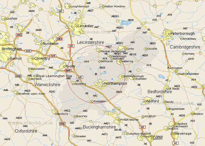
Northamptonshire Map Showing Location of Spratton
Population: 1099
District: Daventry
Easting: 471565 Northing: 269294
Latitude: 52.32 Longitude: -0.95
 = Spratton
District: Daventry
Easting: 471565 Northing: 269294
Latitude: 52.32 Longitude: -0.95
= Spratton
This Spratton map below is supplied by Google. Use the tools in the top left corner to zoom into street level or zoom out for a road map, you may also need to zoom in to see Spratton on the map. Click and drag the map to move around. If the map fails to load try and refresh your browser or zoom in or out (+ or -).
Update - it seems Google no longer allow people to use their maps for free! This Spratton map sometimes loads and sometimes gives a error. I am working on a solution.
Closest 30 Towns or Cities to Spratton (Population over 500)
Brixworth 3.4km Guilsborough 3.87km Pitsford 4.9km East Haddon 4.9km Boughton 5.04km Naseby 7.74km Moulton 7.75km West Haddon 8.14km Long Buckby 8.15km Northampton 8.69km Walgrave 9.25km Harpole 9.55km Overstone 9.8km Clipston 11.12km Kislingbury 11.18km Flore 11.5km Billing 11.72km Great Billing 11.72km Sywell 11.93km Crick 12.6km Yelvertoft 12.61km Welford 13.03km Broughton 13.64km Great Houghton 13.66km Houghton 13.66km Weedon 13.66km Weedon Beck 13.66km Hardingstone 13.75km Bugbrooke 13.75km Welton 14.1km