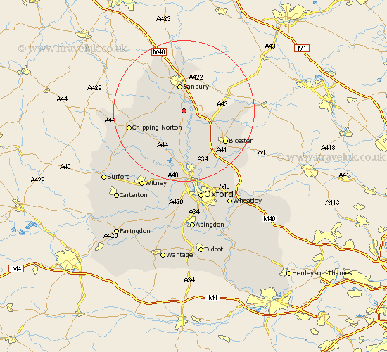
Oxfordshire Map Showing Location of South Newington
Population: 302
District: Cherwell
Easting: 446923 Northing: 231916
Latitude: 51.98 Longitude: -1.32
 = South Newington
District: Cherwell
Easting: 446923 Northing: 231916
Latitude: 51.98 Longitude: -1.32
= South Newington
This South Newington map below is supplied by Google. Use the tools in the top left corner to zoom into street level or zoom out for a road map, you may also need to zoom in to see South Newington on the map. Click and drag the map to move around. If the map fails to load try and refresh your browser or zoom in or out (+ or -).
Update - it seems Google no longer allow people to use their maps for free! This South Newington map sometimes loads and sometimes gives a error. I am working on a solution.
Closest 30 Towns or Cities to South Newington (Population over 500)
Adderbury 1.86km Barford Saint John 3.42km Barford 3.42km Barford St. John 3.42km Barford St John 3.42km Bloxham 3.89km Duns Tew 5.68km Upper Heyford 6.53km Fritwell 6.81km Steeple Aston 7.49km Banbury 7.5km Ardley 8.82km Wroxton 10.89km Hook Norton 11.41km Caversfield 11.68km Enstone 11.76km Tackley 12.97km Cropredy 12.98km Wardington 13.18km Kirtlington 13.41km Fringford 14.19km Chesterton 14.39km Bicester 14.71km Woodstock 14.82km Bletchingdon 15.21km Chipping Norton 15.72km Charlbury 16.55km Chadlington 17.65km Launton 17.65km Stonesfield 18.5km