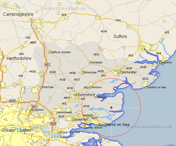
Essex Map Showing Location of Southminster
Population: 3271
Area Size (ha): 73
District: Maldon
Easting: 595985 Northing: 198431
Latitude: 51.65 Longitude: 0.83
 = Southminster
Area Size (ha): 73
District: Maldon
Easting: 595985 Northing: 198431
Latitude: 51.65 Longitude: 0.83
= Southminster
This Southminster map below is supplied by Google. Use the tools in the top left corner to zoom into street level or zoom out for a road map, you may also need to zoom in to see Southminster on the map. Click and drag the map to move around. If the map fails to load try and refresh your browser or zoom in or out (+ or -).
Update - it seems Google no longer allow people to use their maps for free! This Southminster map sometimes loads and sometimes gives a error. I am working on a solution.
Closest 30 Towns or Cities to Southminster (Population over 500)
Mayland 3.45km Burnham 3.71km Burnham-on-Crouch 3.71km Burnham on Crouch 3.71km Tillingham 5.06km Althorne 5.75km Latchingdon 7.14km Latchingdon and Snoreham 7.14km Snoreham 7.14km Canewelon 8km Canewdon 8km Barling 9.88km Fambridge 10.52km North Fambridge 10.52km Goldhanger 10.9km Rochford 10.95km Tollesbury 11.12km Little Wakering 11.64km Cold Norton 11.65km Tolleshunt Major 12.03km Malden 12.73km Maldon 12.73km Purleigh 12.78km Tolleshunt D'Arcy 13.18km Great Wakering 13.18km Hawkwell 13.69km West Mersea 13.77km Heybridge 13.88km Hockley 14.67km Woodham Mortimer 14.87km