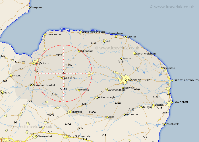
Norfolk Map Showing Location of South Acre
Population: 32
District: Breckland
Easting: 581359 Northing: 312928
Latitude: 52.68 Longitude: 0.68
 = South Acre
District: Breckland
Easting: 581359 Northing: 312928
Latitude: 52.68 Longitude: 0.68
= South Acre
This South Acre map below is supplied by Google. Use the tools in the top left corner to zoom into street level or zoom out for a road map, you may also need to zoom in to see South Acre on the map. Click and drag the map to move around. If the map fails to load try and refresh your browser or zoom in or out (+ or -).
Update - it seems Google no longer allow people to use their maps for free! This South Acre map sometimes loads and sometimes gives a error. I am working on a solution.
Closest 30 Towns or Cities to South Acre (Population over 500)
Castle Acre 1.86km Great Palgrave 3.84km Palgrave 3.84km Swaffham 3.87km Narborough 6.74km Necton 7.69km Litcham 8.69km Massingham 9.34km Great Massingham 9.34km Marham 9.72km Gayton 10.56km Ashill 12.16km Mileham 12.53km Grimston 12.91km East Winch 13.54km Shouldham 13.99km East Rudham 15km Middleton 15.07km Northwold 15.85km Beetley 16.15km Shipdham 16.39km Watton 16.45km Dereham 16.85km East Dereham 16.85km North Runcton 16.95km Tattersett 17.02km Tatterset 17.02km Colkirk 17.15km Stoke Ferry 17.17km Carbrooke 17.49km