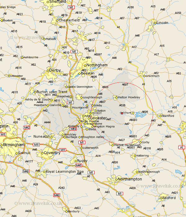
Leicestershire Map Showing Location of Somerby
Population: 791
District: Melton
Easting: 478888 Northing: 308342
Latitude: 52.67 Longitude: -0.83
 = Somerby
District: Melton
Easting: 478888 Northing: 308342
Latitude: 52.67 Longitude: -0.83
= Somerby
This Somerby map below is supplied by Google. Use the tools in the top left corner to zoom into street level or zoom out for a road map, you may also need to zoom in to see Somerby on the map. Click and drag the map to move around. If the map fails to load try and refresh your browser or zoom in or out (+ or -).
Update - it seems Google no longer allow people to use their maps for free! This Somerby map sometimes loads and sometimes gives a error. I am working on a solution.
Closest 30 Towns or Cities to Somerby (Population over 500)
Twyford 5.62km Gaddesby 9.72km Billesdon 10.03km Wymondham 11.45km Houghton 11.55km Houghton-on-the-Hill 11.55km Houghton on the Hill 11.55km Melton Mowbray 11.62km Frisby-on-the-Wreak 11.64km Frisby on the Wreak 11.64km Frisby 11.64km Hallaton 12.98km Hoby 13.45km Queniborough 13.61km Queniboro 13.61km Abkettley 14.13km Ab Kettleby 14.13km Rearsby 14.58km Waltham 14.99km Waltham on the Wolds 14.99km Waltham-on-the-Wolds 14.99km Scalford 14.99km Syston 15.84km Great Glen 17.49km Great Easton 17.6km Kibworth Harcourt 17.96km Kibworth 17.96km Eaton 18.56km Sileby 18.81km Hose 19.06km