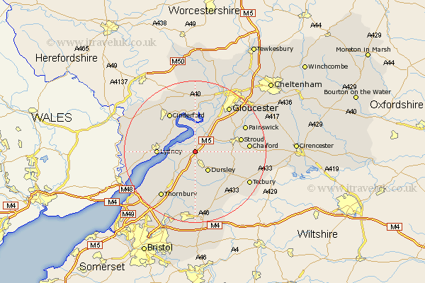
Gloucestershire Map Showing Location of Slimbridge
Population: 1107
District: Stroud
Easting: 373520 Northing: 202117
Latitude: 51.72 Longitude: -2.38
 = Slimbridge
District: Stroud
Easting: 373520 Northing: 202117
Latitude: 51.72 Longitude: -2.38
= Slimbridge
This Slimbridge map below is supplied by Google. Use the tools in the top left corner to zoom into street level or zoom out for a road map, you may also need to zoom in to see Slimbridge on the map. Click and drag the map to move around. If the map fails to load try and refresh your browser or zoom in or out (+ or -).
Update - it seems Google no longer allow people to use their maps for free! This Slimbridge map sometimes loads and sometimes gives a error. I am working on a solution.
Closest 30 Towns or Cities to Slimbridge (Population over 500)
Cam 2.95km Coaley 3.44km North Nibley 5.56km Frampton 5.68km Frampton on Severn 5.68km Frampton-on-Severn 5.68km Berkeley 5.91km Uley 5.91km Awre 6.54km Dursley 6.54km Stonehouse 7.82km Stone 9.38km Wotton-under-Edge 9.55km Wotton under Edge 9.55km Newham 9.88km Newnham 9.88km Lydney 10.33km Woodchester 10.33km Falfield 10.35km Randwick 10.73km Horsley 10.98km Charfield 11.35km Cromhall 12.03km Hardwicke 12.51km Cinderford 13.07km Quedgeley 13.08km Stroud 13.16km Bream 13.16km Nailsworth 13.17km Tytherington 14.7km