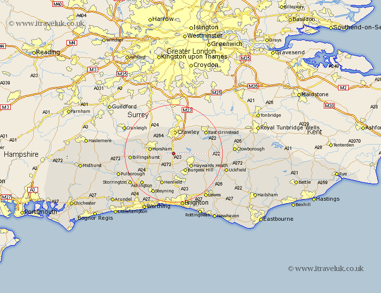
Sussex Map Showing Location of Slaugham
Population: 2226
District: Mid Sussex
Easting: 526198 Northing: 127594
Latitude: 51.03 Longitude: -0.2
 = Slaugham
District: Mid Sussex
Easting: 526198 Northing: 127594
Latitude: 51.03 Longitude: -0.2
= Slaugham
This Slaugham map below is supplied by Google. Use the tools in the top left corner to zoom into street level or zoom out for a road map, you may also need to zoom in to see Slaugham on the map. Click and drag the map to move around. If the map fails to load try and refresh your browser or zoom in or out (+ or -).
Update - it seems Google no longer allow people to use their maps for free! This Slaugham map sometimes loads and sometimes gives a error. I am working on a solution.
Closest 30 Towns or Cities to Slaugham (Population over 500)
Lower Beeding 3.95km South Nutfield 5.01km Cuckfield 5.01km Botney 5.56km Bolney 5.56km Balcombe 6.12km Cowfold 7.26km Nuthurst 7.91km Ardingly 8.16km Burgess Hill 8.75km Rusper 8.76km Worth 8.76km Baywards Heath 8.94km Haywards Heath 8.94km Crawley 9.28km Horsham 9.51km West Horsham 9.51km Turners Hill 9.87km Lindfield 10.03km Southwater 10.65km Warnham 10.85km Albourne 11.18km West Grinstead 11.91km Wivelsfield 12.35km Itchingfield 12.82km Forest Row 12.91km Horsted Keynes 12.95km Hurstpierpoint 13.17km Hassocks 13.78km Keymer 13.78km