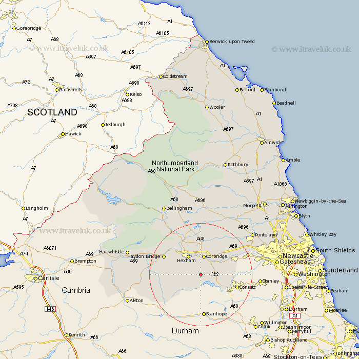
Northumberland Map Showing Location of Slaley
Population: 705
District: Tynedale
Easting: 397862 Northing: 556151
Latitude: 54.9 Longitude: -2.03
 = Slaley
District: Tynedale
Easting: 397862 Northing: 556151
Latitude: 54.9 Longitude: -2.03
= Slaley
This Slaley map below is supplied by Google. Use the tools in the top left corner to zoom into street level or zoom out for a road map, you may also need to zoom in to see Slaley on the map. Click and drag the map to move around. If the map fails to load try and refresh your browser or zoom in or out (+ or -).
Update - it seems Google no longer allow people to use their maps for free! This Slaley map sometimes loads and sometimes gives a error. I am working on a solution.
Closest 30 Towns or Cities to Slaley (Population over 500)
Riding 5.64km Ridingmill 5.64km Corbridge 7.49km Stocksfield 8.32km Hexham 8.55km Sandhoe 9.32km Acomb 10.19km Warden 11.25km Prudhoe 12.97km Ovingham 12.98km Wylam 13.86km Newbrough 14.68km Haydon Bridge 14.77km Challerton 15.42km Chollerton 15.42km Humshaugh 16.14km Stamfordham 18.25km Newburn 20.55km Wark 21.92km Ponteland 24.6km Woolsington 25.84km Haltwhistle 27.18km Dinnington 27.88km Newcastle-on-Tyne 28.66km Newcastle 28.66km Newcastle on Tyne 28.66km Newcastle upon Tyne 28.66km Gosforth 28.84km Bellingham 30.58km Long Benton 31.81km