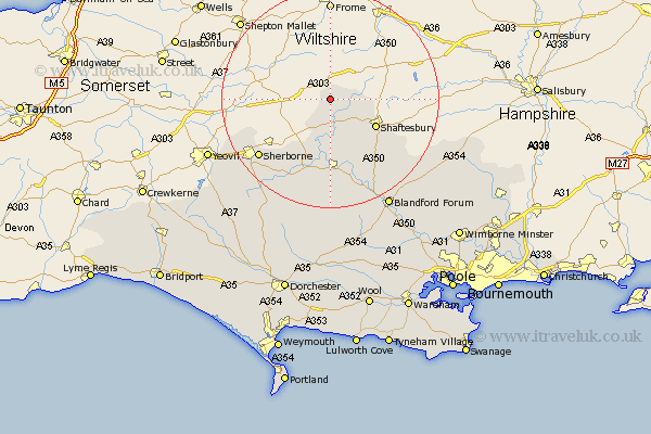
Dorset Map Showing Location of Silton
Population: 134
District: North Dorset
Easting: 377805 Northing: 127957
Latitude: 51.05 Longitude: -2.32
 = Silton
District: North Dorset
Easting: 377805 Northing: 127957
Latitude: 51.05 Longitude: -2.32
= Silton
This Silton map below is supplied by Google. Use the tools in the top left corner to zoom into street level or zoom out for a road map, you may also need to zoom in to see Silton on the map. Click and drag the map to move around. If the map fails to load try and refresh your browser or zoom in or out (+ or -).
Update - it seems Google no longer allow people to use their maps for free! This Silton map sometimes loads and sometimes gives a error. I am working on a solution.
Closest 30 Towns or Cities to Silton (Population over 500)
Bourton 2.19km Gillingham 3.96km East Stour 6.03km Stour 6.03km Stour Provost 7.77km Motcombe 7.91km Marnhull 9.26km Shaftesbury 9.87km Stalbridge 11.66km Fontmell Magna 14.52km Charlton 14.81km Sturminster Newton 15.01km Child Okeford 15.93km Iwerne Minster 15.98km Sherbourne 16.98km Sherborne 16.98km Shillingstone 17.32km Stourpaine 20.26km Pimperne 22.55km Blandford 22.93km Blandford Forum 22.93km Bradford Abbas 23.84km Yetminster 24.18km Winterborne Stickland 24.79km Stickland Winterborne 24.79km Handley 24.79km Buckland Newton 25.84km Leigh 26.12km Tarrant Monkton 26.13km Milton Abbas 27.9km