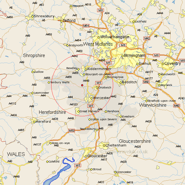
Worcestershire Map Showing Location of Shrawley
Population: 355
District: Malvern Hills
Easting: 380674 Northing: 265098
Latitude: 52.28 Longitude: -2.28
 = Shrawley
District: Malvern Hills
Easting: 380674 Northing: 265098
Latitude: 52.28 Longitude: -2.28
= Shrawley
This Shrawley map below is supplied by Google. Use the tools in the top left corner to zoom into street level or zoom out for a road map, you may also need to zoom in to see Shrawley on the map. Click and drag the map to move around. If the map fails to load try and refresh your browser or zoom in or out (+ or -).
Update - it seems Google no longer allow people to use their maps for free! This Shrawley map sometimes loads and sometimes gives a error. I am working on a solution.
Closest 30 Towns or Cities to Shrawley (Population over 500)
Astley 2.93km Ombersley 3.87km Holt 4.34km Great Witley 4.54km Abberley 5.97km Grimley 6km Hartlebury 6.52km Stourport 7.5km Stourport on Severn 7.5km Stourport-on-Severn 7.5km Hallow 7.75km Fernhill Heath 7.94km Martley 7.94km Droitwich 9.26km Rock 9.69km Clifton 9.8km Clifton upon Teme 9.8km Chaddesley Corbett 10.86km Worcester 10.86km Stone 10.87km Kidderminster 11.35km Bewdley 11.35km Leigh 11.35km Lindridge 13.01km Powick 13.16km Great Dodford 14.5km Dodford 14.5km Crowle 14.65km Stoke Prior 14.85km Bromsgrove 15.74km