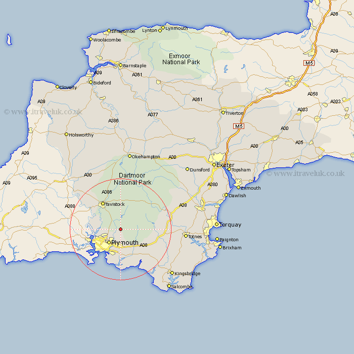
Devon Map Showing Location of Shaugh Prior
Population: 751
District: South Hams
Easting: 254478 Northing: 63203
Latitude: 50.45 Longitude: -4.05
 = Shaugh Prior
District: South Hams
Easting: 254478 Northing: 63203
Latitude: 50.45 Longitude: -4.05
= Shaugh Prior
This Shaugh Prior map below is supplied by Google. Use the tools in the top left corner to zoom into street level or zoom out for a road map, you may also need to zoom in to see Shaugh Prior on the map. Click and drag the map to move around. If the map fails to load try and refresh your browser or zoom in or out (+ or -).
Update - it seems Google no longer allow people to use their maps for free! This Shaugh Prior map sometimes loads and sometimes gives a error. I am working on a solution.
Closest 30 Towns or Cities to Shaugh Prior (Population over 500)
Bickleigh 1.18km Meavy 3.7km Yelverton 4.39km Horrabridge 6.59km Cornwood 6.97km Plymouth 7.29km Walkhampton 7.51km Buckland Monachorum 8.1km Whitechurch 10.98km Whitchurch 10.98km Brixton 11.18km Ivybridge 12.01km Yealmpton 12.08km Tavistock 13.18km Ermington 13.23km Holbeton 14.79km Newton Ferrers 14.87km Gunnislake 14.99km Wembury 15.01km Brent 15.45km South Brent 15.45km Ugborough 15.99km Lamerton 16.04km Modbury 16.22km Dartmoor Forest 17.57km Buckfastleigh 19.23km Diptford 19.69km Milton Abbot 21.87km Widecombe in the Moor 21.93km Widdecombe 21.93km