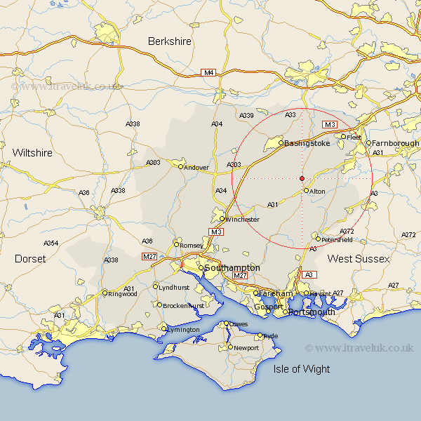
Hampshire Map Showing Location of Shalden
Population: 427
District: East Hampshire
Easting: 469910 Northing: 141361
Latitude: 51.17 Longitude: -1
 = Shalden
District: East Hampshire
Easting: 469910 Northing: 141361
Latitude: 51.17 Longitude: -1
= Shalden
This Shalden map below is supplied by Google. Use the tools in the top left corner to zoom into street level or zoom out for a road map, you may also need to zoom in to see Shalden on the map. Click and drag the map to move around. If the map fails to load try and refresh your browser or zoom in or out (+ or -).
Update - it seems Google no longer allow people to use their maps for free! This Shalden map sometimes loads and sometimes gives a error. I am working on a solution.
Closest 30 Towns or Cities to Shalden (Population over 500)
Alton 3.89km Upton Grey 5.56km Froyle 5.81km Four Marks 6.56km Long Sutton 7.25km Medstead 7.25km Upper Farringdon 7.51km Faringdon 7.51km Farringdon 7.51km Binsted 8.35km Bentley 9.48km Odiham 10.36km Selborne 10.38km Kingsley 10.84km Dummer 11.09km Basing 11.36km Hook 11.65km Crondall 11.84km Bordon Camp 11.85km Bordon 11.85km Basingstoke 12.54km Ropley 12.55km Rotherwick 13.17km North Waltham 13.3km Winchfield 13.77km Headley 13.95km Greatham 14.74km Sherfield 14.87km Sherfield upon Loddon 14.87km New Alresford 14.88km