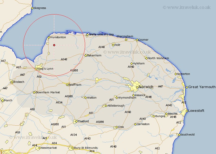
Norfolk Map Showing Location of Sedgeford
Population: 540
District: King's Lynn and West Norfolk
Easting: 571494 Northing: 336697
Latitude: 52.9 Longitude: 0.55
 = Sedgeford
District: King's Lynn and West Norfolk
Easting: 571494 Northing: 336697
Latitude: 52.9 Longitude: 0.55
= Sedgeford
This Sedgeford map below is supplied by Google. Use the tools in the top left corner to zoom into street level or zoom out for a road map, you may also need to zoom in to see Sedgeford on the map. Click and drag the map to move around. If the map fails to load try and refresh your browser or zoom in or out (+ or -).
Update - it seems Google no longer allow people to use their maps for free! This Sedgeford map sometimes loads and sometimes gives a error. I am working on a solution.
Closest 30 Towns or Cities to Sedgeford (Population over 500)
Ingoldesthorpe 4.33km Ingoldisthorpe 4.33km Docking 4.47km Heacham 4.84km Snettisham 5km Hunstanton 6.49km Dersingham 6.49km Great Bircham 7.89km Bircham 7.89km Brancaster 10km Syderstone 12.49km Burnham Market 13.49km Tattersett 14.37km Tatterset 14.37km East Rudham 14.53km South Creake 14.65km Grimston 14.82km North Wootton 15.16km South Wootton 16.77km Massingham 16.77km Great Massingham 16.77km Gayton 18.54km Sculthorpe 18.74km East Winch 18.84km King's Lynn 20.09km Kings Lynn 20.09km Lynn Regis 20.09km Lynn 20.09km Fakenham 20.41km Middleton 21.14km