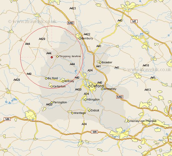
Oxfordshire Map Showing Location of Salford
Population: 339
District: West Oxfordshire
Easting: 428644 Northing: 226217
Latitude: 51.93 Longitude: -1.58
 = Salford
District: West Oxfordshire
Easting: 428644 Northing: 226217
Latitude: 51.93 Longitude: -1.58
= Salford
This Salford map below is supplied by Google. Use the tools in the top left corner to zoom into street level or zoom out for a road map, you may also need to zoom in to see Salford on the map. Click and drag the map to move around. If the map fails to load try and refresh your browser or zoom in or out (+ or -).
Update - it seems Google no longer allow people to use their maps for free! This Salford map sometimes loads and sometimes gives a error. I am working on a solution.
Closest 30 Towns or Cities to Salford (Population over 500)
Chipping Norton 3.45km Churchill 3.7km Kingham 4.35km Barton 6.01km Chadlington 7.2km Hook Norton 8.82km Shipton 9.26km Shipton-under-Wychwood 9.26km Shipton under Wychwood 9.26km Enstone 9.33km Charlbury 10.9km Leafield 13.41km Stonesfield 15.15km Burford 15.21km Minster Lovell 15.21km Barford St John 15.85km Barford Saint John 15.85km Barford 15.85km Barford St. John 15.85km Hailey 16.33km Bloxham 16.59km Duns Tew 17.14km Witney 18.04km North Leigh 18.05km Shilton 18.56km Brize Norton 18.56km Deddington 19.1km Wroxton 19.43km Steeple Aston 19.52km Adderbury 19.72km