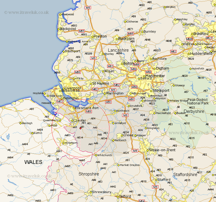
Cheshire Map Showing Location of Saighton
Population: 192
District: Chester
Easting: 344274 Northing: 361785
Latitude: 53.15 Longitude: -2.83
 = Saighton
District: Chester
Easting: 344274 Northing: 361785
Latitude: 53.15 Longitude: -2.83
= Saighton
This Saighton map below is supplied by Google. Use the tools in the top left corner to zoom into street level or zoom out for a road map, you may also need to zoom in to see Saighton on the map. Click and drag the map to move around. If the map fails to load try and refresh your browser or zoom in or out (+ or -).
Update - it seems Google no longer allow people to use their maps for free! This Saighton map sometimes loads and sometimes gives a error. I am working on a solution.
Closest 30 Towns or Cities to Saighton (Population over 500)
Waverton 2.9km Christleton 3.7km Tattenhall 5.79km Great Barrow 5.99km Barrow 5.99km Tarvin 7.12km Mickle Trafford 7.5km Chester 7.86km Dodleston 8km Farndon 8.13km Harthill 9.27km Ashton 9.97km Saughall 10.74km Great Saughall 10.74km Mollington 10.8km Tarporley 11.11km Tilston 11.18km Elton 11.18km Dunham-on-the-Hill 11.34km Dunham on the Hill 11.34km Dunham 11.34km Kelsall 12.45km Kelshall Hill 12.45km Kelsall Hill 12.45km Bunbury 12.78km Delamere 13.35km Helsby 13.71km Ellesmere Port 15.47km Malpas 15.48km Little Budworth 15.99km