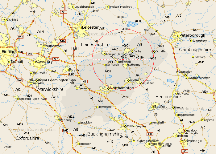
Northamptonshire Map Showing Location of Rushton
Population: 451
District: Kettering
Easting: 484972 Northing: 282478
Latitude: 52.43 Longitude: -0.75
 = Rushton
District: Kettering
Easting: 484972 Northing: 282478
Latitude: 52.43 Longitude: -0.75
= Rushton
This Rushton map below is supplied by Google. Use the tools in the top left corner to zoom into street level or zoom out for a road map, you may also need to zoom in to see Rushton on the map. Click and drag the map to move around. If the map fails to load try and refresh your browser or zoom in or out (+ or -).
Update - it seems Google no longer allow people to use their maps for free! This Rushton map sometimes loads and sometimes gives a error. I am working on a solution.
Closest 30 Towns or Cities to Rushton (Population over 500)
Rothwell 3.86km Rowell 3.86km Kettering 4.34km Geddington 4.52km Desborough 4.52km Cottingham 5.56km Wilbarston 6.51km Broughton 7.49km Stanion 7.73km Corby 7.92km Caldecott 9.54km Weldon 9.66km Isham 9.86km Brigstock 10.34km Burton Latimer 10.85km Walgrave 12km Gretton 12.47km Finedon 13.65km Clipston 13.69km Woodford 14.48km Thrapston 15.15km Wellingborough 15.21km Islip 15.71km Ringstead 16.43km Brixworth 16.49km Irthlingborough 16.49km Naseby 16.78km Sywell 16.83km Overstone 17.28km Pitsford 17.37km