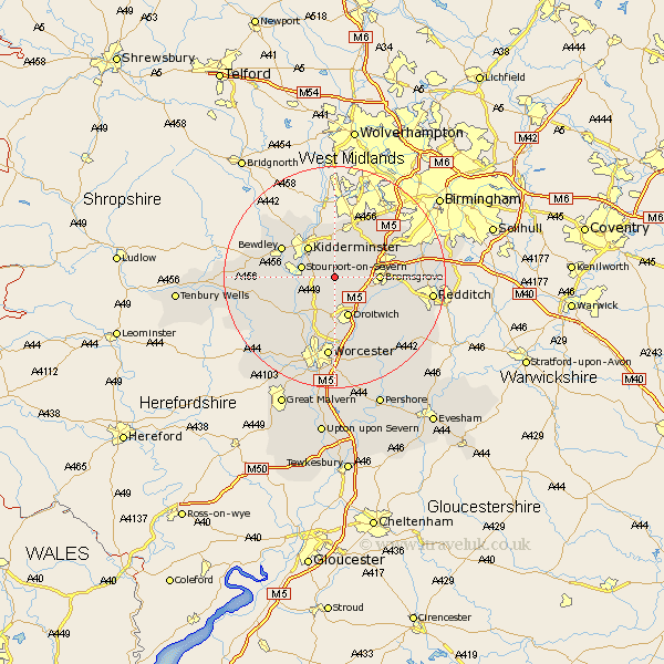
Worcestershire Map Showing Location of Rushock
Population: 138
District: Wyre Forest
Easting: 387509 Northing: 270637
Latitude: 52.33 Longitude: -2.18
 = Rushock
District: Wyre Forest
Easting: 387509 Northing: 270637
Latitude: 52.33 Longitude: -2.18
= Rushock
This Rushock map below is supplied by Google. Use the tools in the top left corner to zoom into street level or zoom out for a road map, you may also need to zoom in to see Rushock on the map. Click and drag the map to move around. If the map fails to load try and refresh your browser or zoom in or out (+ or -).
Update - it seems Google no longer allow people to use their maps for free! This Rushock map sometimes loads and sometimes gives a error. I am working on a solution.
Closest 30 Towns or Cities to Rushock (Population over 500)
Chaddesley Corbett 2.17km Hartlebury 3.4km Stone 3.88km Dodford 5.96km Great Dodford 5.96km Stourport on Severn 5.96km Stourport-on-Severn 5.96km Stourport 5.96km Kidderminster 7.17km Droitwich 7.74km Bromsgrove 7.93km Ombersley 8.15km Belbroughton 8.69km Stoke Prior 8.75km Churchill 9.27km Lickey End 9.79km Lickey 9.79km Astley 9.79km Holt 10.31km Clent 10.32km Bewdley 10.63km Fernhill Heath 11.18km Hanbury 11.71km Hagley 12.01km Grimley 12.01km Great Witley 12.62km Romsley 12.96km Abberley 13km Barnt Green 13.71km Hallow 13.74km