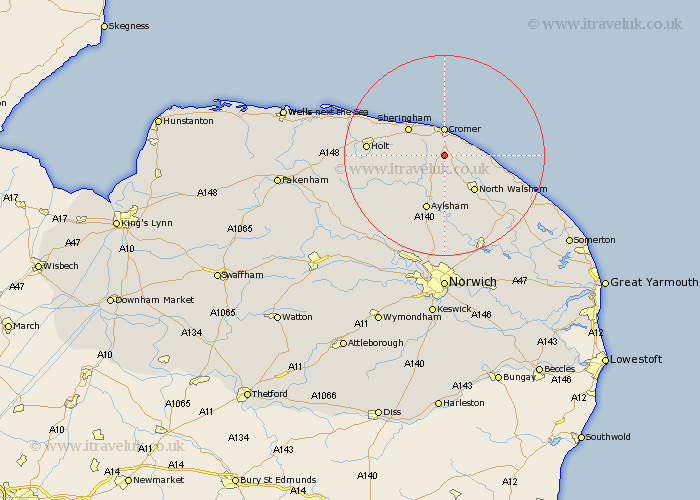
Norfolk Map Showing Location of Roughton
Population: 866
District: North Norfolk
Easting: 622006 Northing: 336896
Latitude: 52.88 Longitude: 1.3
 = Roughton
District: North Norfolk
Easting: 622006 Northing: 336896
Latitude: 52.88 Longitude: 1.3
= Roughton
This Roughton map below is supplied by Google. Use the tools in the top left corner to zoom into street level or zoom out for a road map, you may also need to zoom in to see Roughton on the map. Click and drag the map to move around. If the map fails to load try and refresh your browser or zoom in or out (+ or -).
Update - it seems Google no longer allow people to use their maps for free! This Roughton map sometimes loads and sometimes gives a error. I am working on a solution.
Closest 30 Towns or Cities to Roughton (Population over 500)
Northrepps 2.91km Overstrand 5km Cromer 5.56km Runton 6.49km West Runton 6.49km Erpingham 6.49km Trunch 7.67km Mundersley 8.04km Mundesley 8.04km Sheringham 8.71km North Walsham 9.28km Felmingham 9.53km Weybourne 11.49km Aylsham 11.62km Bacton 11.78km Marsham 13.39km Corpusty 13.42km Worstead 14.28km Walcott 14.53km Holt 14.65km Hevingham 14.99km Lammas 14.99km Lamas Little Hautbois 14.99km Little Hautbois 14.99km Cawston 15.76km Briston 16.09km Smallburgh 16.42km Coltishall 17.27km Melton Constable 18.28km Mellon Constable 18.28km