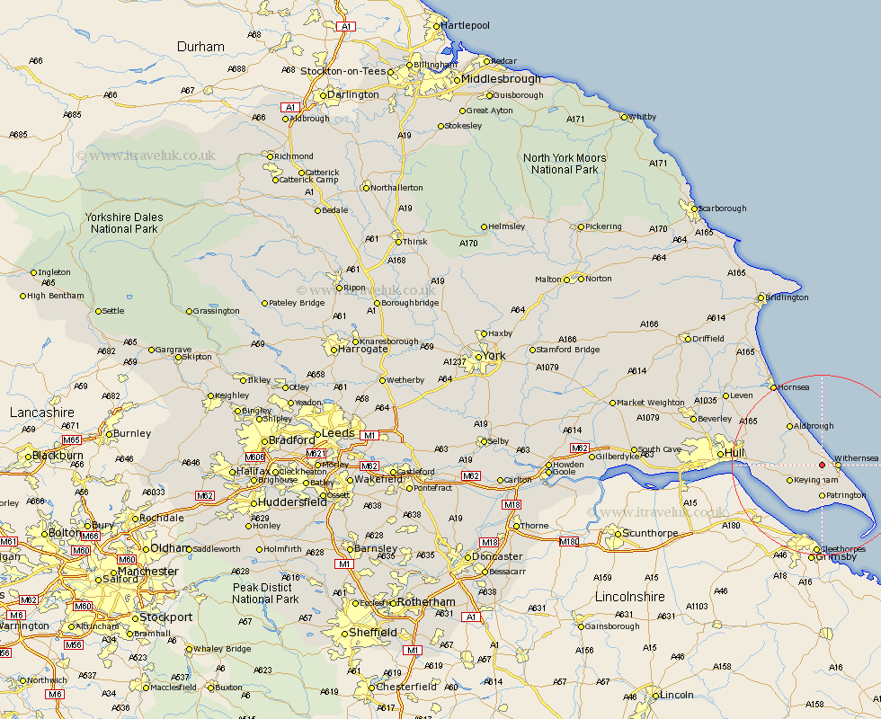
Yorkshire Map Showing Location of Rimswell
Population: 198
Easting: 530815 Northing: 428173
Latitude: 53.73 Longitude: -0.02
 = Rimswell
Easting: 530815 Northing: 428173
Latitude: 53.73 Longitude: -0.02
= Rimswell
This Rimswell map below is supplied by Google. Use the tools in the top left corner to zoom into street level or zoom out for a road map, you may also need to zoom in to see Rimswell on the map. Click and drag the map to move around. If the map fails to load try and refresh your browser or zoom in or out (+ or -).
Update - it seems Google no longer allow people to use their maps for free! This Rimswell map sometimes loads and sometimes gives a error. I am working on a solution.
Closest 30 Towns or Cities to Rimswell (Population over 500)
Roos 2.87km Withernsea 3.29km Ottringham 5.74km Burton Pidsea 6.62km Patrington 7.41km Keyingham 7.55km Burstwick 7.67km Walkington 9.53km Thorngumbold 10.04km Thorngumbald 10.04km Hedon 10.96km Aldbrough 11.37km Easington 11.48km Sproatley 12.29km Preston 12.61km Paull 14.37km Skirlaugh Station 17.92km Sutton-on-Hull 20.49km Sutton 20.49km Sutton on Hull 20.49km Kingston upon Hull 20.91km Hull 20.99km Hornsea 20.99km Wawne 23.13km Cottingham 24.74km Leven 25.81km Woodmansey 25.82km Anlaby 27.41km Hessle 27.47km Brandsburton 27.6km