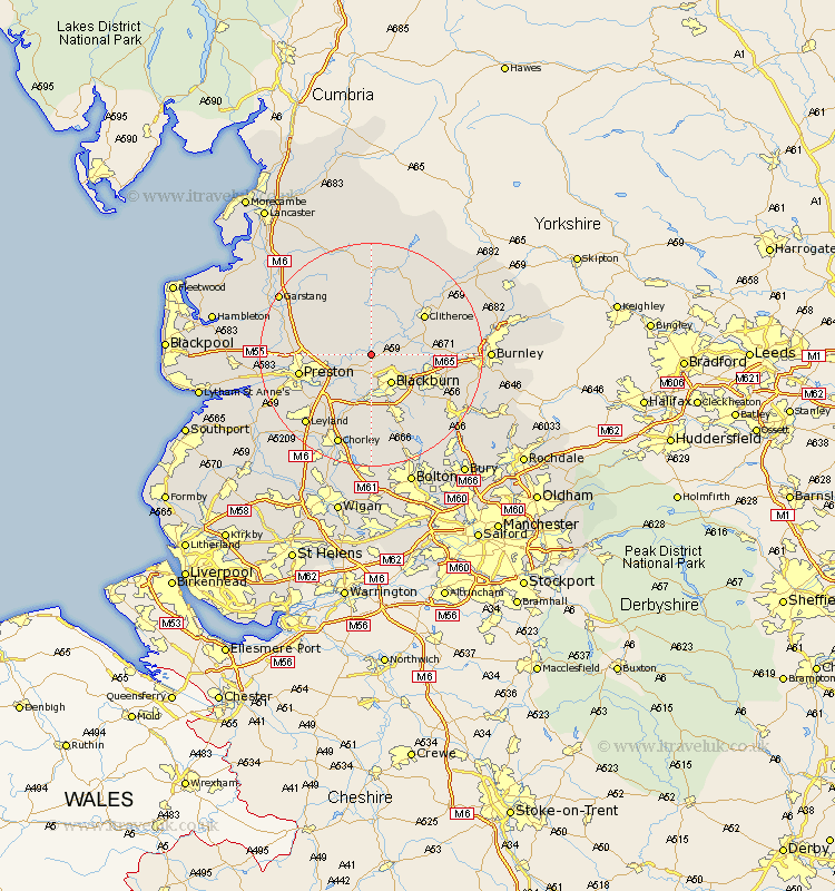
Lancashire Map Showing Location of Ribchester
Population: 1535
District: Ribble Valley
Easting: 364876 Northing: 433899
Latitude: 53.8 Longitude: -2.53
 = Ribchester
District: Ribble Valley
Easting: 364876 Northing: 433899
Latitude: 53.8 Longitude: -2.53
= Ribchester
This Ribchester map below is supplied by Google. Use the tools in the top left corner to zoom into street level or zoom out for a road map, you may also need to zoom in to see Ribchester on the map. Click and drag the map to move around. If the map fails to load try and refresh your browser or zoom in or out (+ or -).
Update - it seems Google no longer allow people to use their maps for free! This Ribchester map sometimes loads and sometimes gives a error. I am working on a solution.
Closest 30 Towns or Cities to Ribchester (Population over 500)
Mellor 3.7km Wilpshire 3.77km Longridge 4.95km Langho 5.47km Blackburn 6.46km Grimsargh 6.57km Samlesbury 6.61km Whalley 7.88km Great Harwood 7.88km Goosnargh 8.95km Rishton 9.47km Chipping 9.83km Hoghton 9.83km Clayton le Moors 10.53km Clayton le Moor 10.53km Clayton-le-Moors 10.53km Withnell 11.17km Church 11.32km Clitheroe 11.47km Oswaldtwistle 11.48km Darwen 11.95km Waddington 12.02km Simonstone 12.18km Accrington 12.6km Preston 12.6km Brinscall 13.16km Sabden 13.26km Broughton 13.26km Barton 13.26km Altham 13.27km