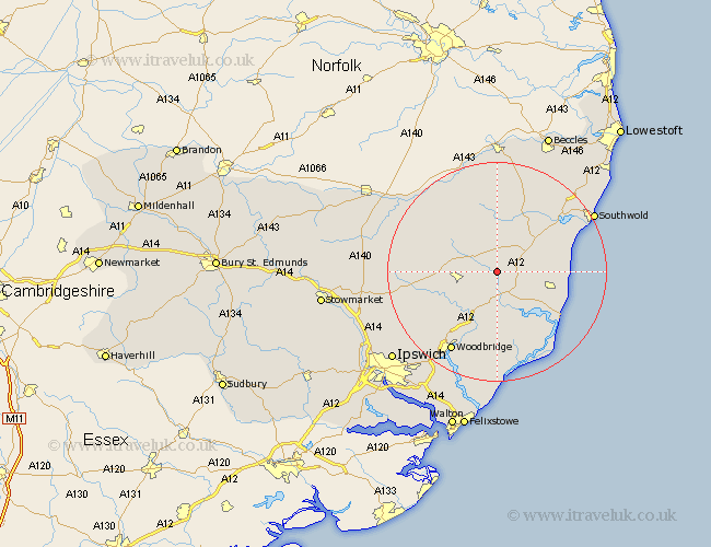
Suffolk Map Showing Location of Rendham
Population: 262
District: Suffolk Coastal
Easting: 634415 Northing: 265055
Latitude: 52.23 Longitude: 1.43
 = Rendham
District: Suffolk Coastal
Easting: 634415 Northing: 265055
Latitude: 52.23 Longitude: 1.43
= Rendham
This Rendham map below is supplied by Google. Use the tools in the top left corner to zoom into street level or zoom out for a road map, you may also need to zoom in to see Rendham on the map. Click and drag the map to move around. If the map fails to load try and refresh your browser or zoom in or out (+ or -).
Update - it seems Google no longer allow people to use their maps for free! This Rendham map sometimes loads and sometimes gives a error. I am working on a solution.
Closest 30 Towns or Cities to Rendham (Population over 500)
Saxmundham 4.9km Yoxford 6.78km Framlingham 7.06km Snape 7.18km Laxfield 8.69km Cookley 9.34km Dennington 9.81km Leiston 9.81km Wickham Market 10.32km Tunstall 11.18km Wenhaston 12.21km Holton 12.48km Rendlesham 13.02km Worlingworth 13.02km Halesworth 13.75km Ufford 14.16km Thorpe 14.52km Thorpeness 14.52km Stradbroke 14.65km Aldeburgh 14.66km Fressingfield 15.83km Otley 16.48km Woodbridge 16.82km Melton 16.82km Debenham 17.13km Wangford 18km Orford 18.02km Martlesham 19km Sutton 19.38km Grundisburgh 19.39km