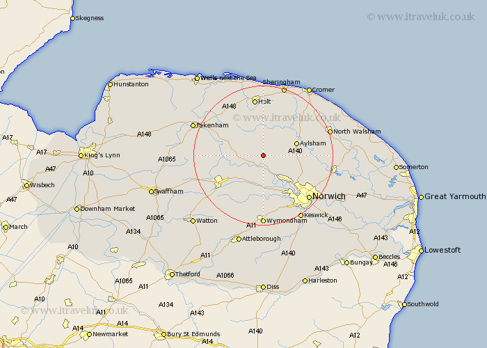
Norfolk Map Showing Location of Reepham
Population: 2325
Area Size (ha): 70
District: Broadland
Easting: 610319 Northing: 321524
Latitude: 52.75 Longitude: 1.12
 = Reepham
Area Size (ha): 70
District: Broadland
Easting: 610319 Northing: 321524
Latitude: 52.75 Longitude: 1.12
= Reepham
This Reepham map below is supplied by Google. Use the tools in the top left corner to zoom into street level or zoom out for a road map, you may also need to zoom in to see Reepham on the map. Click and drag the map to move around. If the map fails to load try and refresh your browser or zoom in or out (+ or -).
Update - it seems Google no longer allow people to use their maps for free! This Reepham map sometimes loads and sometimes gives a error. I am working on a solution.
Closest 30 Towns or Cities to Reepham (Population over 500)
Witchingham 1.86km Cawston 3.84km Lyng 5.01km Bawdeswell 5.91km Corpusty 7.5km Foulsham 7.68km Foulham 7.68km Marsham 9.16km Aylsham 9.7km Hockering 9.86km Hindolveston 10.01km Hevingham 10.1km Taverham 10.3km North Elmham 11.37km Drayton 11.45km Briston 11.62km Horsford 11.65km Melton Constable 12.45km Mellon Constable 12.45km Mattishall 12.46km Hainford 12.89km Haynford 12.89km Erpingham 12.89km Costessey 13km Horsham 13.45km Horsham Saint Faith 13.45km Horsham St. Faith 13.45km Horsham St Faith 13.45km Beetley 13.97km Dereham 14.41km