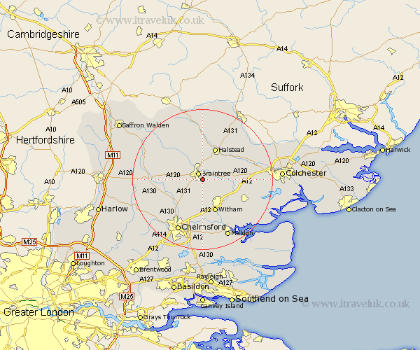
Essex Map Showing Location of Rayne
Population: 2120
Area Size (ha): 59
District: Braintree
Easting: 577842 Northing: 221883
Latitude: 51.87 Longitude: 0.58
 = Rayne
Area Size (ha): 59
District: Braintree
Easting: 577842 Northing: 221883
Latitude: 51.87 Longitude: 0.58
= Rayne
This Rayne map below is supplied by Google. Use the tools in the top left corner to zoom into street level or zoom out for a road map, you may also need to zoom in to see Rayne on the map. Click and drag the map to move around. If the map fails to load try and refresh your browser or zoom in or out (+ or -).
Update - it seems Google no longer allow people to use their maps for free! This Rayne map sometimes loads and sometimes gives a error. I am working on a solution.
Closest 30 Towns or Cities to Rayne (Population over 500)
Braintree 2.17km Cressing 2.18km Bradwell 2.29km Stisted 2.94km Black Notley 2.95km Panfield 4.94km Rivenhall 6.82km Coggeshall 6.87km Great Leighs 7.2km Gosfield 7.41km Terling 7.76km Kelvedon 8.83km Feering 9.34km Hatfield Peverel 9.34km Shalford 9.36km Halstead 9.88km Witham 9.89km Great Bardfield 10.1km Little Waltham 10.11km Wickham Bishops 10.9km Earls Colne 10.9km Great Totham 10.92km Totham 10.92km Sible Hedingham 11.12km Boreham 11.35km Wethersfield 11.53km Stebbing 11.59km Great Tey 12.02km Tiptree 12.7km Wakes Colne 12.71km