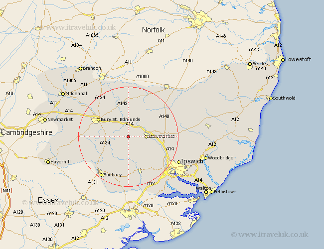
Suffolk Map Showing Location of Rattlesden
Population: 811
District: Mid Suffolk
Easting: 597093 Northing: 257858
Latitude: 52.18 Longitude: 0.88
 = Rattlesden
District: Mid Suffolk
Easting: 597093 Northing: 257858
Latitude: 52.18 Longitude: 0.88
= Rattlesden
This Rattlesden map below is supplied by Google. Use the tools in the top left corner to zoom into street level or zoom out for a road map, you may also need to zoom in to see Rattlesden on the map. Click and drag the map to move around. If the map fails to load try and refresh your browser or zoom in or out (+ or -).
Update - it seems Google no longer allow people to use their maps for free! This Rattlesden map sometimes loads and sometimes gives a error. I am working on a solution.
Closest 30 Towns or Cities to Rattlesden (Population over 500)
Finborough 3.88km Great Finborough 3.88km Woolpit 3.88km Bradfield Saint George 5.98km Bradfield St. George 5.98km Bradfield 5.98km Bradfield St George 5.98km Elmswell 6.01km Stowmarket 6.82km Hitcham 7.49km Norton 7.5km Cockfield 7.76km Haughley 7.76km Thurston 8.7km Rushbrooke 8.78km Ringshall 8.8km Bildeston 9.54km Old Newton 9.82km Pakenham 9.88km Great Bricett 10.07km Lavenham 10.87km Lawshall 10.88km Badwell Ash 11.35km Great Barton 12.21km Bacton 12.98km Ixworth 13.42km Bury St. Edmunds 13.56km Bury Saint Edmunds 13.56km Bury St Edmunds 13.56km Mendlesham 14.53km