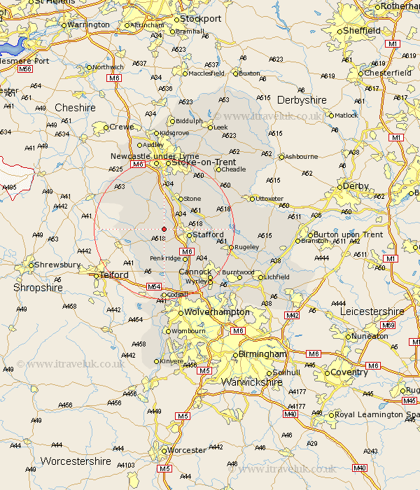
Staffordshire Map Showing Location of Ranton
Population: 385
District: Stafford
Easting: 386522 Northing: 324406
Latitude: 52.82 Longitude: -2.2
 = Ranton
District: Stafford
Easting: 386522 Northing: 324406
Latitude: 52.82 Longitude: -2.2
= Ranton
This Ranton map below is supplied by Google. Use the tools in the top left corner to zoom into street level or zoom out for a road map, you may also need to zoom in to see Ranton on the map. Click and drag the map to move around. If the map fails to load try and refresh your browser or zoom in or out (+ or -).
Update - it seems Google no longer allow people to use their maps for free! This Ranton map sometimes loads and sometimes gives a error. I am working on a solution.
Closest 30 Towns or Cities to Ranton (Population over 500)
Seighford 1.12km Haughton 3.71km Eccleshall 5km Gnossall 5.01km Gnosall 5.01km Hopton 6.97km Stafford 6.97km Church Eaton 7.75km High Offley 9.15km Adbaston 10.25km Stone 10.29km Bednall 10.55km Penkridge 10.84km Swinnerton 11.18km Swynnerton 11.18km Wheaton Aston 11.18km Standon 12.45km Blymhill 12.45km Weston upon Trent 12.46km Weston 12.46km Hilderstone 13.6km Weston under Lizard 14.14km Weston-under-Lizard 14.14km Weston 14.14km Barlaston 14.99km Brewood 15km Colwich 15.03km Huntington 17.15km Fulford 17.31km Whitmore 17.59km