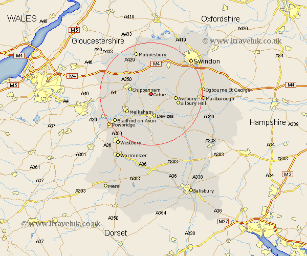
Wiltshire Map Showing Location of Calne
Population: 11499
Area Size (ha): 279
District: North Wiltshire
Easting: 400000 Northing: 170532
Latitude: 51.43 Longitude: -2
 = Calne
Area Size (ha): 279
District: North Wiltshire
Easting: 400000 Northing: 170532
Latitude: 51.43 Longitude: -2
= Calne
This Calne map below is supplied by Google. Use the tools in the top left corner to zoom into street level or zoom out for a road map, you may also need to zoom in to see Calne on the map. Click and drag the map to move around. If the map fails to load try and refresh your browser or zoom in or out (+ or -).
Update - it seems Google no longer allow people to use their maps for free! This Calne map sometimes loads and sometimes gives a error. I am working on a solution.
Closest 30 Towns or Cities to Calne (Population over 500)
Bremhill 2.96km Cherhill 3.93km Hillmarton 4.37km Hilmarton 4.37km Roundway 7.5km Bishops Cannings 8.18km Christian Malford 8.19km Chippenham 8.3km Lacock 8.9km Laycock 8.9km Devizes 9.33km Sutton Benger 9.4km Rowde 9.55km Lyneham 9.55km Broad Town 10.78km Seend 10.92km Corsham 11.55km Melksham 11.85km Great Somerford 12.04km Somerford 12.04km Broad Hinton 12.82km Potterne 13.02km Brinkworth 13.03km Stanton St Quintin 13.09km Stanton St. Quintin 13.09km Stanton 13.09km Stanton Saint Quintin 13.09km Wooton Bassett 13.1km Wootton Bassett 13.1km Worton 13.77km