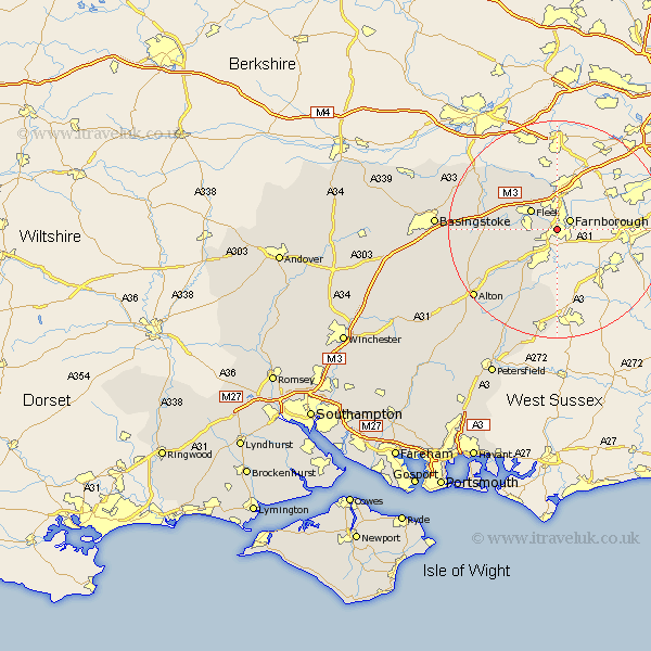
Hampshire Map Showing Location of Aldershot
Population: 50411
Area Size (ha): 1568
District: Rushmoor
Easting: 486066 Northing: 150871
Latitude: 51.25 Longitude: -0.77
 = Aldershot
Area Size (ha): 1568
District: Rushmoor
Easting: 486066 Northing: 150871
Latitude: 51.25 Longitude: -0.77
= Aldershot
This Aldershot map below is supplied by Google. Use the tools in the top left corner to zoom into street level or zoom out for a road map, you may also need to zoom in to see Aldershot on the map. Click and drag the map to move around. If the map fails to load try and refresh your browser or zoom in or out (+ or -).
Update - it seems Google no longer allow people to use their maps for free! This Aldershot map sometimes loads and sometimes gives a error. I am working on a solution.
Closest 30 Towns or Cities to Aldershot (Population over 500)
Farnborough 2.97km Fleet 5.94km Crondall 6.88km Blackwater 7.51km Winchfield 8.33km Hartley Wintney 9.84km Bentley 10.17km Odiham 11.6km Long Sutton 12.18km Hook 12.89km Binsted 13.77km Froyle 13.96km Rotherwick 14.4km Headley 15.23km Bordon Camp 15.92km Bordon 15.92km Kingsley 16.38km Upton Grey 16.66km Sherfield 18.26km Sherfield upon Loddon 18.26km Basing 18.65km Bramshot 18.68km Alton 19.91km Liphook 20.51km Selborne 21.88km Basingstoke 22.11km Bramley 22.14km Farringdon 22.5km Faringdon 22.5km Upper Farringdon 22.5km