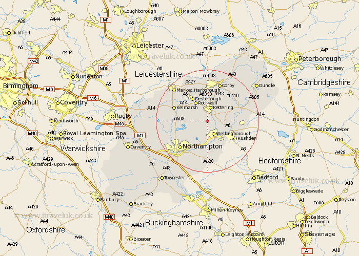
Northamptonshire Map Showing Location of Pytchley
Population: 496
District: Kettering
Easting: 486267 Northing: 273234
Latitude: 52.35 Longitude: -0.73
 = Pytchley
District: Kettering
Easting: 486267 Northing: 273234
Latitude: 52.35 Longitude: -0.73
= Pytchley
This Pytchley map below is supplied by Google. Use the tools in the top left corner to zoom into street level or zoom out for a road map, you may also need to zoom in to see Pytchley on the map. Click and drag the map to move around. If the map fails to load try and refresh your browser or zoom in or out (+ or -).
Update - it seems Google no longer allow people to use their maps for free! This Pytchley map sometimes loads and sometimes gives a error. I am working on a solution.
Closest 30 Towns or Cities to Pytchley (Population over 500)
Isham 2.26km Broughton 2.93km Burton Latimer 4.53km Kettering 5.67km Walgrave 5.96km Wellingborough 6km Finedon 7.04km Sywell 8.16km Rowell 8.69km Rothwell 8.69km Wilby 9.33km Overstone 9.33km Great Doddington 9.54km Doddington 9.54km Irthlingborough 9.79km Geddington 9.86km Desborough 10.85km Moulton 10.86km Earls Barton 11.18km Woodford 11.47km Irchester 11.49km Higham Ferrers 11.61km Pitsford 11.61km Brixworth 11.91km Wollaston 12.01km Ringstead 12.45km Great Billing 12.48km Billing 12.48km Rushden 12.61km Stanwick 13km