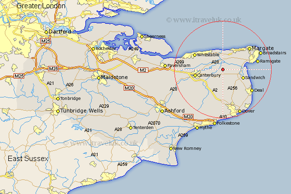
Kent Map Showing Location of Preston
Population: 713
District: Dover
Easting: 625367 Northing: 160674
Latitude: 51.3 Longitude: 1.23
 = Preston
District: Dover
Easting: 625367 Northing: 160674
Latitude: 51.3 Longitude: 1.23
= Preston
This Preston map below is supplied by Google. Use the tools in the top left corner to zoom into street level or zoom out for a road map, you may also need to zoom in to see Preston on the map. Click and drag the map to move around. If the map fails to load try and refresh your browser or zoom in or out (+ or -).
Update - it seems Google no longer allow people to use their maps for free! This Preston map sometimes loads and sometimes gives a error. I am working on a solution.
Closest 30 Towns or Cities to Preston (Population over 500)
Wingham 3.88km Chislet 4.37km Monkton 5.08km St Nicholas at Wade 5.68km St. Nicholas at Wade 5.68km Saint Nicholas at Wade 5.68km Staple 5.68km Hoath 5.93km Littlebourne 5.93km Minster 6.08km Broomfield 8.14km Sturry 8.32km Birchington 8.74km Eastry 8.75km Sandwich 8.92km Worth 9.84km Herne Bay 10.16km Hackington 10.59km Manston 10.81km Bridge 11km Canterbury 11.42km Northbourne 11.59km Blean 12.75km Chestfield 12.85km Sibertswold 12.98km Shepherdswell 12.98km Whitstable 13.09km Eythorne 13.44km Lower Hardres 13.76km Sholden 13.96km