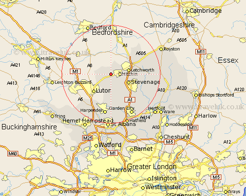
Hertfordshire Map Showing Location of Pirton
Population: 1217
District: North Hertfordshire
Easting: 515675 Northing: 229331
Latitude: 51.95 Longitude: -0.32
 = Pirton
District: North Hertfordshire
Easting: 515675 Northing: 229331
Latitude: 51.95 Longitude: -0.32
= Pirton
This Pirton map below is supplied by Google. Use the tools in the top left corner to zoom into street level or zoom out for a road map, you may also need to zoom in to see Pirton on the map. Click and drag the map to move around. If the map fails to load try and refresh your browser or zoom in or out (+ or -).
Update - it seems Google no longer allow people to use their maps for free! This Pirton map sometimes loads and sometimes gives a error. I am working on a solution.
Closest 30 Towns or Cities to Pirton (Population over 500)
Hitchin 3.43km Great Offley 3.88km Offley 3.88km Ickleford 3.9km Letchworth 7.1km Wymondley 7.1km Great Wymondley 7.1km Stevenage 7.79km Graveley 8.21km Baldock 9.86km Weston 10.28km Kimpton 11.35km Codicote 12.5km Walkern 13.1km Aston 13.63km Knebworth 14.4km Welwyn 14.68km Ashwell 14.7km Markyate 15.88km Markyatestreet 15.88km Datchworth 15.95km Cottered 16.1km Benington 16.61km Bennington 16.61km Wheathampstead 16.84km Harpenden 16.84km Flamstead 16.85km Welwyn Garden City 18.5km Garden City 18.5km Watton at Stone 18.56km