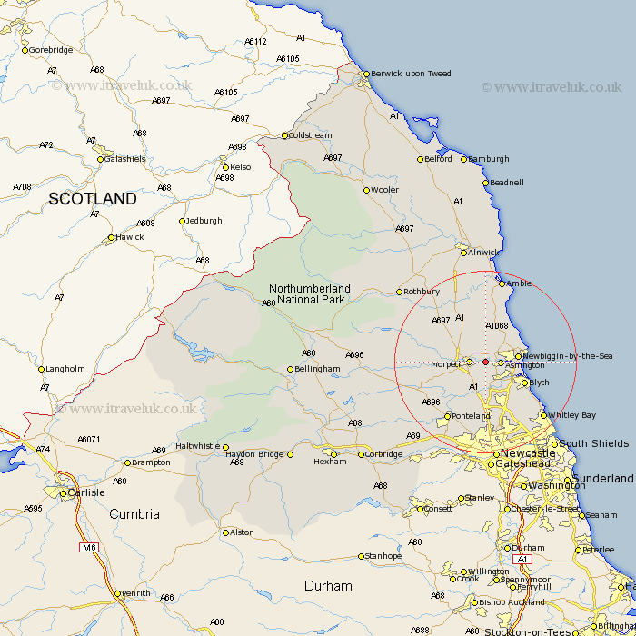
Northumberland Map Showing Location of Pegswood
Population: 3211
Area Size (ha): 56
District: Castle Morpeth
Easting: 423355 Northing: 585887
Latitude: 55.17 Longitude: -1.63
 = Pegswood
Area Size (ha): 56
District: Castle Morpeth
Easting: 423355 Northing: 585887
Latitude: 55.17 Longitude: -1.63
= Pegswood
This Pegswood map below is supplied by Google. Use the tools in the top left corner to zoom into street level or zoom out for a road map, you may also need to zoom in to see Pegswood on the map. Click and drag the map to move around. If the map fails to load try and refresh your browser or zoom in or out (+ or -).
Update - it seems Google no longer allow people to use their maps for free! This Pegswood map sometimes loads and sometimes gives a error. I am working on a solution.
Closest 30 Towns or Cities to Pegswood (Population over 500)
Hepscott 2.14km Ashington 3km Morpeth 3.18km Hebron 3.67km Bedlington 4.87km Newbiggin-by-the-Sea 6.47km Newbiggin by the Sea 6.47km Ellington 6.99km Stannington 7.71km Lynemouth 7.74km Blyth 9.14km Blythe 9.14km Dudley 10.23km Longhorsley 11.24km Cramlington 11.57km Seaton Sluice 12.98km East Chevington 13.35km Thirston 13.35km East Thirston 13.35km Dinnington 13.36km Seaton Delaval 13.37km Felton 13.64km Seghill 14.02km Ponteland 14.95km Shiremoor 15.24km Killingworth 15.43km Longframlington 16.08km Swarland 16.12km Woolsington 16.98km Whitley Bay 17.22km