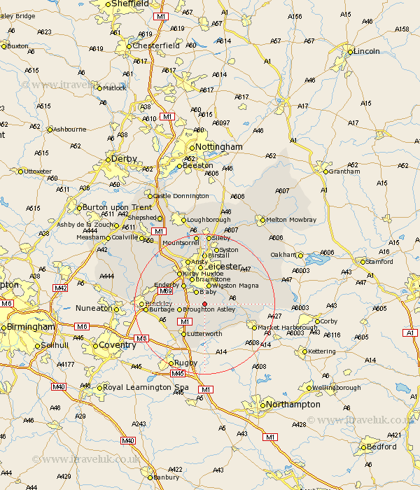
Leicestershire Map Showing Location of Peatling Magna
Population: 194
District: Harborough
Easting: 459911 Northing: 293232
Latitude: 52.53 Longitude: -1.12
 = Peatling Magna
District: Harborough
Easting: 459911 Northing: 293232
Latitude: 52.53 Longitude: -1.12
= Peatling Magna
This Peatling Magna map below is supplied by Google. Use the tools in the top left corner to zoom into street level or zoom out for a road map, you may also need to zoom in to see Peatling Magna on the map. Click and drag the map to move around. If the map fails to load try and refresh your browser or zoom in or out (+ or -).
Update - it seems Google no longer allow people to use their maps for free! This Peatling Magna map sometimes loads and sometimes gives a error. I am working on a solution.
Closest 30 Towns or Cities to Peatling Magna (Population over 500)
Countesthorpe 2.17km Glen Parva 3.71km Glen Parka 3.71km Blaby 4.34km Cosby 4.88km Wigston Magna 5.67km Wigston 5.67km Whetstone 5.84km Oadby 6km Narborough 6.75km Great Glen 6.75km Broughton Astley 7.01km Walton-in-Knaptoft 7.41km Walton 7.41km Gilmarton 7.74km Gilmorton 7.74km Enderby 7.92km Croft 8.1km Braunstone 8.15km Kibworth 9.02km Kibworth Harcourt 9.02km Stoney Stanton 10.15km Husbands Bosworth 10.3km Sapcote 10.31km Lutterworth 10.84km Leiscester 11.18km Leicester 11.18km Sharnford 11.42km Kirby Muxloe 11.47km Claybrooke Parva 11.57km