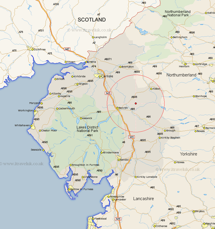
Cumbria Map Showing Location of Ousby
Population: 362
District: Eden
Easting: 362411 Northing: 534053
Latitude: 54.7 Longitude: -2.58
 = Ousby
District: Eden
Easting: 362411 Northing: 534053
Latitude: 54.7 Longitude: -2.58
= Ousby
This Ousby map below is supplied by Google. Use the tools in the top left corner to zoom into street level or zoom out for a road map, you may also need to zoom in to see Ousby on the map. Click and drag the map to move around. If the map fails to load try and refresh your browser or zoom in or out (+ or -).
Update - it seems Google no longer allow people to use their maps for free! This Ousby map sometimes loads and sometimes gives a error. I am working on a solution.
Closest 30 Towns or Cities to Ousby (Population over 500)
Culgaith 5.66km Langwathby 5.67km Lasonby 8.36km Lazonby 8.36km Kirkby Thore 9.51km Kirkoswald 10.54km Long Marton 11.92km Long Marston 11.92km Ainstable 14.71km Appleby 16.16km Skelton 18.21km Dacre 18.56km Greystoke 19.05km Crosby Ravensworth 20.38km Shap 21.08km Wetheral 23.82km Hayton 24.67km Farlam 24.93km Orton 25.97km Brough 27.36km Hesket Newmarket 28.08km Irthington 28.48km Brampton 29.41km Dalston 29.63km Kirkby Stephen 29.98km Caldbeck 30.2km Carlisle 30.31km Tebay 31.5km Stanwix 31.59km Ravenstonedale 33.28km