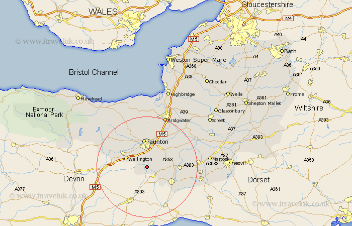
Somerset Map Showing Location of Otterford
Population: 389
District: Taunton Deane
Easting: 322711 Northing: 115509
Latitude: 50.93 Longitude: -3.1
 = Otterford
District: Taunton Deane
Easting: 322711 Northing: 115509
Latitude: 50.93 Longitude: -3.1
= Otterford
This Otterford map below is supplied by Google. Use the tools in the top left corner to zoom into street level or zoom out for a road map, you may also need to zoom in to see Otterford on the map. Click and drag the map to move around. If the map fails to load try and refresh your browser or zoom in or out (+ or -).
Update - it seems Google no longer allow people to use their maps for free! This Otterford map sometimes loads and sometimes gives a error. I am working on a solution.
Closest 30 Towns or Cities to Otterford (Population over 500)
Pitminster 3.89km West Buckland 6.92km Trull 7.51km Combe St. Nicholas 7.93km Combe Saint Nicholas 7.93km Combe St Nicholas 7.93km Hatch Beauchamp 8.94km Wellington 8.98km Broadway 9.34km Creech Saint Michael 10.96km Creech St Michael 10.96km Creech St. Michael 10.96km Taunton 11.18km Oake 11.62km Norton Fitzwarren 11.66km Chard 11.93km Ilminster 12.85km Ilton 12.98km North Curry 13.16km West Monkton 13.44km Milverton 14.01km Fivehead 14.83km Kingston 14.88km Bishops Lydeard 15.94km Stoke St Gregory 16.12km Stoke St. Gregory 16.12km Stoke Saint Gregory 16.12km Winsham 16.81km Curry Rivel 17.78km Wiveliscombe 18.81km