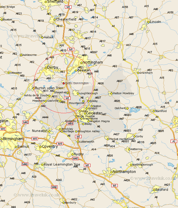
Leicestershire Map Showing Location of Castle Donington
Population: 5971
Area Size (ha): 264
District: North West Leicestershire
Easting: 444908 Northing: 326442
Latitude: 52.83 Longitude: -1.33
 = Castle Donington
Area Size (ha): 264
District: North West Leicestershire
Easting: 444908 Northing: 326442
Latitude: 52.83 Longitude: -1.33
= Castle Donington
This Castle Donington map below is supplied by Google. Use the tools in the top left corner to zoom into street level or zoom out for a road map, you may also need to zoom in to see Castle Donington on the map. Click and drag the map to move around. If the map fails to load try and refresh your browser or zoom in or out (+ or -).
Update - it seems Google no longer allow people to use their maps for free! This Castle Donington map sometimes loads and sometimes gives a error. I am working on a solution.
Closest 30 Towns or Cities to Castle Donington (Population over 500)
Diseworth 3.7km Kegworth 4.84km Breedon-on-the-Hill 7.14km Breedon 7.14km Breedon on the Hill 7.14km Belton 7.41km Shepshed 7.54km Sheepshed 7.54km Hathern 7.89km Worthington 8.66km Coleorton 10.29km Swannington 11.18km Loughborough 11.63km Ashby de la Zouch 12.89km Coalville 13.16km Ravenstone with Snibston 15.49km Ravenstone 15.49km Woodhouse 15.76km Packington 15.77km Quorndon 15.79km Burton 16.34km Burton on the Wolds 16.34km Burton-on-the-Wolds 16.34km Barrow upon Soar 16.6km Barrow 16.6km Wymeswold 16.64km Wimeswould 16.64km Measham 17.14km Heather 17.6km Mountsorrel 17.89km