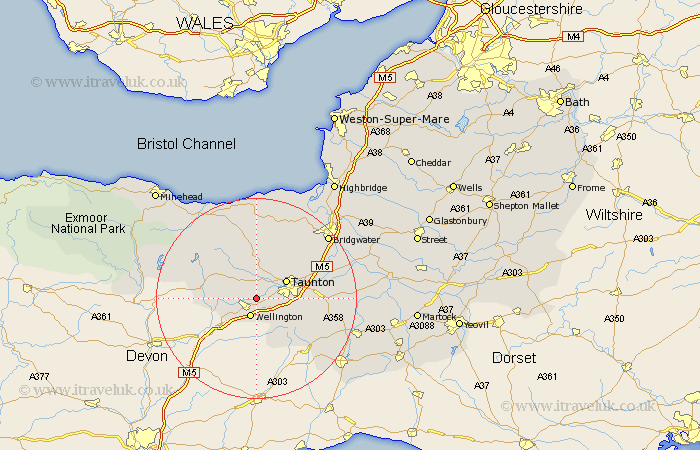
Somerset Map Showing Location of Nynehead
Population: 378
District: Taunton Deane
Easting: 315805 Northing: 123035
Latitude: 51 Longitude: -3.2
 = Nynehead
District: Taunton Deane
Easting: 315805 Northing: 123035
Latitude: 51 Longitude: -3.2
= Nynehead
This Nynehead map below is supplied by Google. Use the tools in the top left corner to zoom into street level or zoom out for a road map, you may also need to zoom in to see Nynehead on the map. Click and drag the map to move around. If the map fails to load try and refresh your browser or zoom in or out (+ or -).
Update - it seems Google no longer allow people to use their maps for free! This Nynehead map sometimes loads and sometimes gives a error. I am working on a solution.
Closest 30 Towns or Cities to Nynehead (Population over 500)
Oake 1.86km West Buckland 3.88km Wellington 3.89km Milverton 3.96km Norton Fitzwarren 5.09km Trull 5.83km Taunton 6.91km Pitminster 6.91km Bishops Lydeard 7.51km Wiveliscombe 8.96km Kingston 9.43km West Monkton 11.87km Creech St. Michael 12.96km Creech Saint Michael 12.96km Creech St Michael 12.96km Hatch Beauchamp 14.12km Spaxton 14.22km Stogumber 16.39km North Curry 16.43km Durleigh 16.68km Nether Stowey 16.84km North Petherton 16.97km Combe St Nicholas 17.89km Combe Saint Nicholas 17.89km Combe St. Nicholas 17.89km Broadway 17.94km Williton 18.85km Stoke Saint Gregory 19.02km Stoke St. Gregory 19.02km Stoke St Gregory 19.02km