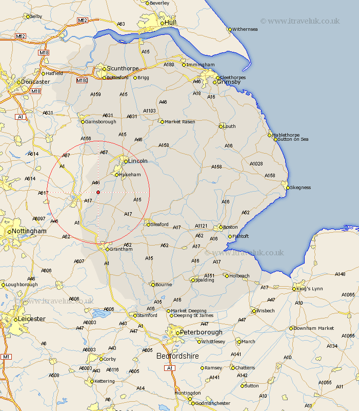
Lincolnshire Map Showing Location of Norton Disney
Population: 244
District: North Kesteven
Easting: 488112 Northing: 358567
Latitude: 53.12 Longitude: -0.68
 = Norton Disney
District: North Kesteven
Easting: 488112 Northing: 358567
Latitude: 53.12 Longitude: -0.68
= Norton Disney
This Norton Disney map below is supplied by Google. Use the tools in the top left corner to zoom into street level or zoom out for a road map, you may also need to zoom in to see Norton Disney on the map. Click and drag the map to move around. If the map fails to load try and refresh your browser or zoom in or out (+ or -).
Update - it seems Google no longer allow people to use their maps for free! This Norton Disney map sometimes loads and sometimes gives a error. I am working on a solution.
Closest 30 Towns or Cities to Norton Disney (Population over 500)
Bassingham 3.34km Swinderby 3.87km Aubourn 5.79km Eagle 7.4km Thorpe on the Hill 8.12km Thorpe 8.12km Thorpe-on-the-Hill 8.12km North Scarle 9.84km Claypole 9.86km Hykeham 9.97km North Hykeham 9.97km Wellingore 10.18km Welbourn 10.5km Navenby 11.28km Fulbeck 11.43km Waddington 11.45km Caythorpe 12.44km Skellingthorpe 13.71km Branston 16.24km Lincoln 16.37km Saxilby 16.83km Heighington 17.16km Cranwell 17.19km Long Bennington 17.26km Bloxholm 18.19km Bloxholme 18.19km Washingborough 18.23km Brauncewell 18.27km Nocton 18.64km Torksey 18.82km