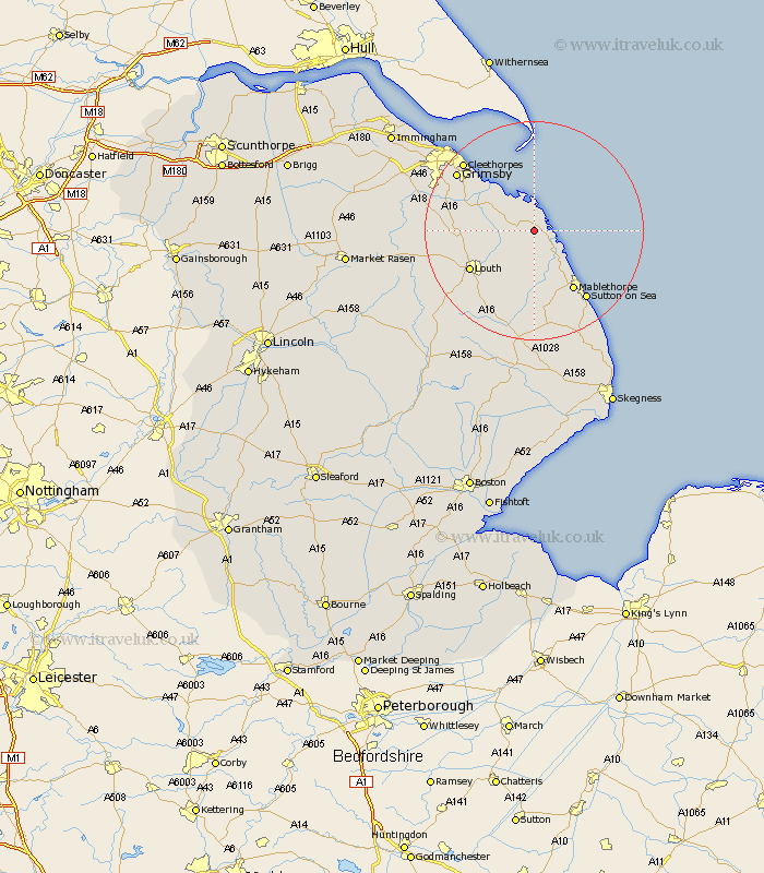
Lincolnshire Map Showing Location of North Somercotes
Population: 1599
District: East Lindsey
Easting: 542815 Northing: 395127
Latitude: 53.43 Longitude: 0.15
 = North Somercotes
District: East Lindsey
Easting: 542815 Northing: 395127
Latitude: 53.43 Longitude: 0.15
= North Somercotes
This North Somercotes map below is supplied by Google. Use the tools in the top left corner to zoom into street level or zoom out for a road map, you may also need to zoom in to see North Somercotes on the map. Click and drag the map to move around. If the map fails to load try and refresh your browser or zoom in or out (+ or -).
Update - it seems Google no longer allow people to use their maps for free! This North Somercotes map sometimes loads and sometimes gives a error. I am working on a solution.
Closest 30 Towns or Cities to North Somercotes (Population over 500)
Saltfleet 2.88km Saltfleetby St Clement 4.31km Saltfleetby 4.31km Saltfleetby Saint Clement 4.31km Saltfleetby St. Clement 4.31km Grainthorpe 5.77km Manby 8.11km North Coates 8.57km Grimoldby 8.62km Fulstow 11.19km Tetney 12.36km Mablethorpe 12.95km Legbourne 12.95km Louth 13.3km North Thoresby 13.76km Sutton on Sea 15.69km Sutton-on-Sea 15.69km Humberston 16.46km Humberstone 16.46km Holton le Clay 17.08km Great Grimsby 17.28km Grimsby 17.28km Cleethorpes 17.76km Waltham 18.97km Alford 20.5km Great Coates 21.41km Huttoft 21.8km binbrook 22.08km Laceby 23.72km Willoughby 24.31km