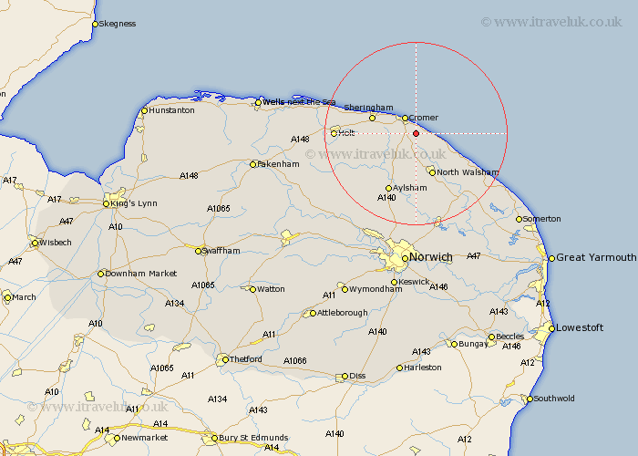
Norfolk Map Showing Location of Northrepps
Population: 839
District: North Norfolk
Easting: 624161 Northing: 338856
Latitude: 52.9 Longitude: 1.33
 = Northrepps
District: North Norfolk
Easting: 624161 Northing: 338856
Latitude: 52.9 Longitude: 1.33
= Northrepps
This Northrepps map below is supplied by Google. Use the tools in the top left corner to zoom into street level or zoom out for a road map, you may also need to zoom in to see Northrepps on the map. Click and drag the map to move around. If the map fails to load try and refresh your browser or zoom in or out (+ or -).
Update - it seems Google no longer allow people to use their maps for free! This Northrepps map sometimes loads and sometimes gives a error. I am working on a solution.
Closest 30 Towns or Cities to Northrepps (Population over 500)
Overstrand 2.17km Roughton 2.91km Cromer 4.33km West Runton 6.7km Runton 6.7km Mundersley 6.71km Mundesley 6.71km Trunch 7.14km Erpingham 9.29km Sheringham 9.68km North Walsham 9.85km Bacton 10.54km Felmingham 11.12km Weybourne 12.84km Walcott 13.42km Aylsham 14.13km Worstead 14.61km Marsham 15.84km Corpusty 16.31km Little Hautbois 16.68km Lammas 16.68km Lamas Little Hautbois 16.68km Smallburgh 16.77km Holt 16.77km Hevingham 17.27km Happisburgh 18.2km Cawston 18.58km Coltishall 18.67km Briston 18.74km Stalham 19.27km