Somerset Map Showing Location of North Curry
Population: 1588
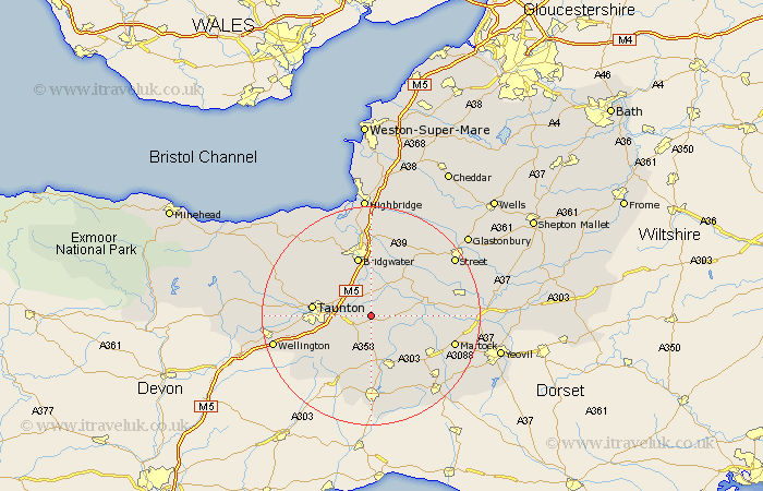
District: Taunton Deane
Easting: 332200 Northing: 124651
Latitude: 51.02 Longitude: -2.97
 = North Curry
District: Taunton Deane
Easting: 332200 Northing: 124651
Latitude: 51.02 Longitude: -2.97
= North Curry
This North Curry map below is supplied by Google. Use the tools in the top left corner to zoom into street level or zoom out for a road map, you may also need to zoom in to see North Curry on the map. Click and drag the map to move around. If the map fails to load try and refresh your browser or zoom in or out (+ or -).
Update - it seems Google no longer allow people to use their maps for free! This North Curry map sometimes loads and sometimes gives a error. I am working on a solution.
Closest 30 Towns or Cities to North Curry (Population over 500)
Stoke St Gregory 2.97km Stoke St. Gregory 2.97km Stoke Saint Gregory 2.97km Creech St. Michael 3.5km Creech St Michael 3.5km Creech Saint Michael 3.5km Fivehead 3.96km Hatch Beauchamp 4.38km Curry Rivel 5.83km West Monkton 6.9km Ilton 8.2km Broadway 9.27km Othery 9.42km Langport 9.51km North Petherton 9.9km Ilminster 9.91km Middlezoy 10.37km Taunton 10.65km Trull 10.66km Bridgwater 11.36km Bridgewater 11.36km Weston Zoyland 11.36km Kingston 11.87km High Ham 11.87km Pitminster 11.88km Kingsbury 12.24km Kingsbury Episcopi 12.24km Durleigh 12.55km Norton Fitzwarren 12.95km Combe St. Nicholas 13.18km