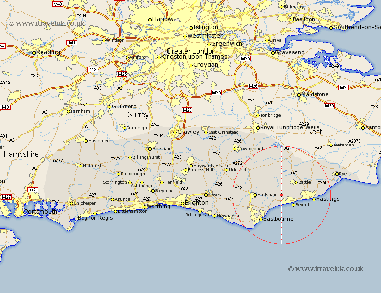
Sussex Map Showing Location of Ninfield
Population: 1538
District: Wealden
Easting: 570035 Northing: 110310
Latitude: 50.87 Longitude: 0.42
 = Ninfield
District: Wealden
Easting: 570035 Northing: 110310
Latitude: 50.87 Longitude: 0.42
= Ninfield
This Ninfield map below is supplied by Google. Use the tools in the top left corner to zoom into street level or zoom out for a road map, you may also need to zoom in to see Ninfield on the map. Click and drag the map to move around. If the map fails to load try and refresh your browser or zoom in or out (+ or -).
Update - it seems Google no longer allow people to use their maps for free! This Ninfield map sometimes loads and sometimes gives a error. I am working on a solution.
Closest 30 Towns or Cities to Ninfield (Population over 500)
Catsfield 2.98km Crowhurst 5.85km Hurstmonceaux 6.13km Hurstmonceux 6.13km Herstmonceux 6.13km Bexhill 6.36km Battle 8.07km Mountfield 8.19km Pevensey Bay 8.21km Pevensey 8.77km Sedlescombe 9.89km Hailsham 10.53km Westfield 11.16km Hellingly 11.7km Warbleton 11.93km Horeham 12.95km Horam 12.95km Hastings 13km Robertsbridge 13.43km Eastbourne 13.52km Brede 14.01km Heathfield 14.01km Polegate 14.86km Etchingham 14.87km Burwash 15.01km Hurst Green 15.23km Fairlight 15.31km Guestling 15.31km Chiddingly 16.78km Jevington 16.83km