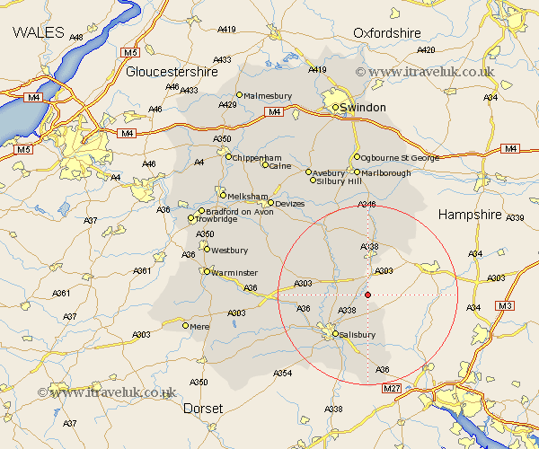
Wiltshire Map Showing Location of Newton Tony
Population: 408
District: Salisbury
Easting: 422146 Northing: 139077
Latitude: 51.15 Longitude: -1.68
 = Newton Tony
District: Salisbury
Easting: 422146 Northing: 139077
Latitude: 51.15 Longitude: -1.68
= Newton Tony
This Newton Tony map below is supplied by Google. Use the tools in the top left corner to zoom into street level or zoom out for a road map, you may also need to zoom in to see Newton Tony on the map. Click and drag the map to move around. If the map fails to load try and refresh your browser or zoom in or out (+ or -).
Update - it seems Google no longer allow people to use their maps for free! This Newton Tony map sometimes loads and sometimes gives a error. I am working on a solution.
Closest 30 Towns or Cities to Newton Tony (Population over 500)
Idmiston 2.98km Lugershall 6.03km Ludgershall 6.03km Durrington 6.89km Amesbury 7.22km Winterbourne 7.25km Winterbourne Dauntsey 7.25km Winterslow 7.51km Bulford 8.04km Tidworth 9.33km North Tidworth 9.33km Lark Hill 10.01km Figheldean 10.18km Farley 11.12km Netheravon 11.59km New Sarum 11.6km Salisbury 11.6km Alderbury 13.44km Enford 13.77km South Newton 13.95km Britford 14.22km Odstock 14.74km Wilton 14.79km Collingbourne Ducis 15km Shrewton 15.55km Whiteparish 16.84km Downton 17.04km Coombe Bissett 17.43km Combebissett 17.43km Upavon 17.49km