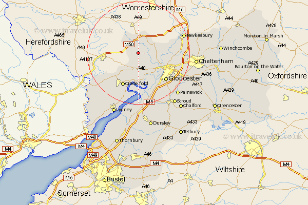
Gloucestershire Map Showing Location of Newent
Population: 4027
Area Size (ha): 116
District: Forest of Dean
Easting: 372501 Northing: 226211
Latitude: 51.93 Longitude: -2.4
 = Newent
Area Size (ha): 116
District: Forest of Dean
Easting: 372501 Northing: 226211
Latitude: 51.93 Longitude: -2.4
= Newent
This Newent map below is supplied by Google. Use the tools in the top left corner to zoom into street level or zoom out for a road map, you may also need to zoom in to see Newent on the map. Click and drag the map to move around. If the map fails to load try and refresh your browser or zoom in or out (+ or -).
Update - it seems Google no longer allow people to use their maps for free! This Newent map sometimes loads and sometimes gives a error. I am working on a solution.
Closest 30 Towns or Cities to Newent (Population over 500)
Tibberton 5.05km Dymock 6.01km Redmarley D'Abitot 6.53km Corse 6.86km Hartpury 7.1km Huntley 7.41km Longhope 8.16km Ashleworth 9.14km Milcheldean 9.36km Mitcheldean 9.36km Drybrook 11.53km Cinderford 14.17km Deerhurst 14.2km Hardwicke 14.67km Innsworth 14.8km Newham 15km Newnham 15km Gloucester 15.15km Quedgeley 15.24km Lydbrook 15.62km Staverton 16.11km Churchdown 16.94km Hucclecote 17.52km Brockworth 18.5km Tewkesbury 18.66km Awre 18.67km Frampton-on-Severn 18.67km Frampton 18.67km Frampton on Severn 18.67km Coleford 20.21km