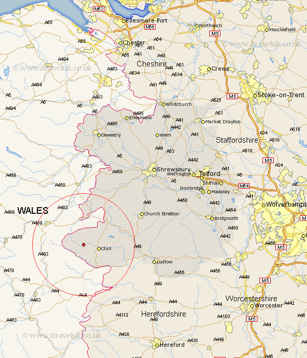
Shropshire Map Showing Location of Newcastle
District: South Shropshire
Easting: 324090 Northing: 282330
Latitude: 52.43 Longitude: -3.12
 = Newcastle
Easting: 324090 Northing: 282330
Latitude: 52.43 Longitude: -3.12
= Newcastle
This Newcastle map below is supplied by Google. Use the tools in the top left corner to zoom into street level or zoom out for a road map, you may also need to zoom in to see Newcastle on the map. Click and drag the map to move around. If the map fails to load try and refresh your browser or zoom in or out (+ or -).
Update - it seems Google no longer allow people to use their maps for free! This Newcastle map sometimes loads and sometimes gives a error. I am working on a solution.
Closest 30 Towns or Cities to Newcastle (Population over 500)
Clun 5.94km North Lydbury 11.89km Lydbury North 11.89km Bucknell 13.52km Chirburg 16.83km Chirbury 16.83km Wistanstow 18.45km Shelve 18.96km Craven Arms 19.21km Church Stretton 25.06km Minsterley 25.46km Ludlow 27.04km Diddlebury 27.36km Rushbury 28.64km Pontesbury 28.8km Westbury 30km Bitterley 31.87km Caynham 31.91km Alberbury 33.47km Hanwood 34.41km Great Hanwood 34.41km Condover 34.58km Baystonhill 35.89km Ford 36.3km Berrington 37.08km Ditton Priors 37.99km Llanyblodwel 38.93km Bicton 39.03km Pant 39.06km Great Ness 39.86km