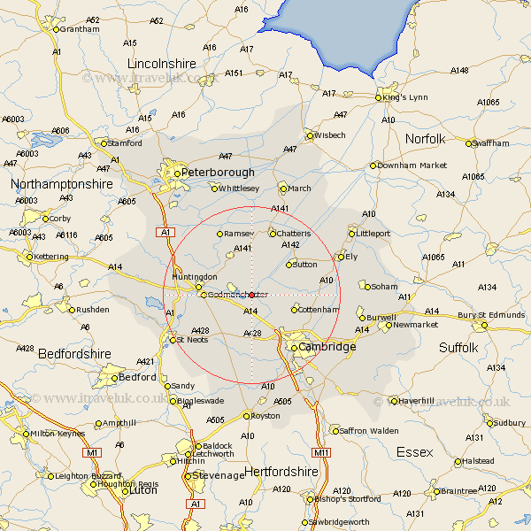
Cambridgeshire Map Showing Location of Needingworth
Population: 1782
Area Size (ha): 58
District: Huntingdonshire
Easting: 535174 Northing: 270627
Latitude: 52.32 Longitude: -0.02
 = Needingworth
Area Size (ha): 58
District: Huntingdonshire
Easting: 535174 Northing: 270627
Latitude: 52.32 Longitude: -0.02
= Needingworth
This Needingworth map below is supplied by Google. Use the tools in the top left corner to zoom into street level or zoom out for a road map, you may also need to zoom in to see Needingworth on the map. Click and drag the map to move around. If the map fails to load try and refresh your browser or zoom in or out (+ or -).
Update - it seems Google no longer allow people to use their maps for free! This Needingworth map sometimes loads and sometimes gives a error. I am working on a solution.
Closest 30 Towns or Cities to Needingworth (Population over 500)
Swavesey 2.18km Over 2.27km Fen Stanton 3.87km St. Ives 3.87km St Ives 3.87km Saint Ives 3.87km Bluntisham 4.34km Earith 4.34km Hemingford Abbots 5.66km West Hemingford 5.66km Willingham 5.66km Long Stanton 5.86km Colne 6km Hemingford Grey 6.8km Hemingford 6.8km Wyton 7.04km Somersham 7.49km Oakington 7.94km Hilton 7.94km Elsworth 8.16km Cottenham 9.8km Warboys 9.87km Dry Drayton 9.88km Durolipons 10.2km Godmanchester 10.2km Sutton 10.85km Wistow 10.85km Histon 10.86km Huntingdon 11.48km Girton 11.5km